Tag Archives: camping

northisland

Finally I did travel whole New Zealand, covered more than 75000 kms most of them I traveled on South Island. There is still one area which I didn’t explore and that is northland, upper part of New Zealand. For last 8 month I had my bike in storage as long I have been on Chatham Island for my summer job. Bike soon for the whole time, had no wolf and insurance, first thing to do get the bike legal back on the road, I was not sure if my bike fire up right away, after 8 month standing in storage expected to charge battery first, but any way I give try before taking battery out to recharge, what a surprise bike fired up without trouble. Wof (warrant of fitness) took 5 minutes and I got my sticker that bike is save to ride.

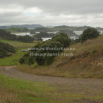
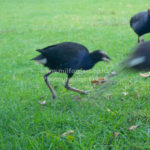
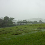
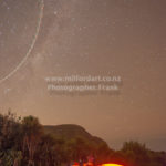
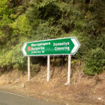
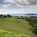
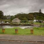
On my first day t traveled to sheep island a nature reserve which is controlled by Auckland council. Don’t get surprised by the first impression it look more than high security track than a reserve. It is worth to stay there for a few days, because one of the endangered birds living there the Takahe they are a bit bigger than Pukeko. Later that day the ranger showed up and informed all camper that whole northland expect a severe weather warning with more than 200mml rain over night, some camper moved on other stayed, I stayed. Rain was hammering over night on my tent, with ear plugs I couldn’t hear much and have had a good sleep. Next morning the whole camp looked like a paddle of water barley any “try” pitch, except where I put up my tent. I stayed for two nights until weather cleared up. My next stop is Otamure bay a DOC camp ground by my check in the lady want sell me a bin bag for $5 which is apparently compulsory the bag was that big that could store my whole belongings on the bike, however I asked her if she is serious about the dice of the rubbishy bag, and for 1 apple would be the rubbishy bag a bit to big, if she could provide a bag which is more suitable for an apple, I was not sure if she felt offended or not but she took the rubbishy bag back and didn’t charge me $5 for it.

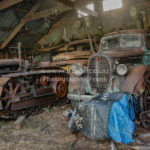
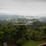
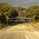
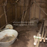
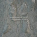
On the way up north is an historic Kauri Gum field, Gumdiggers Park on Heath Rd. The park is well presented with many old relic displayed how kauri gum has been digged out.

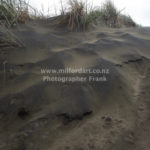
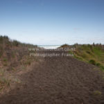
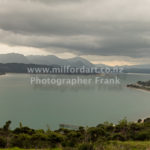
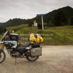
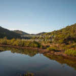
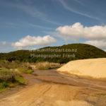
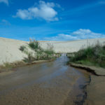
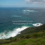
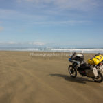
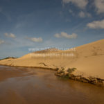
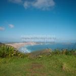
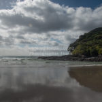
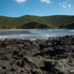
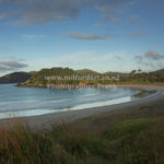
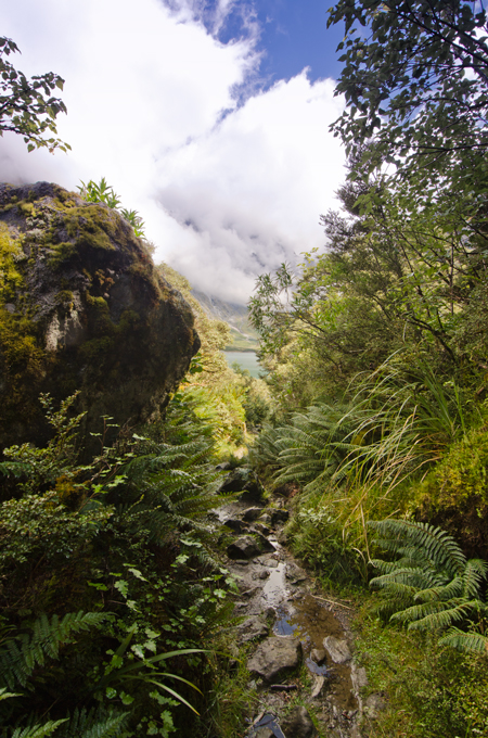
My next stop was Rarawa Beach, it has easy access to the beach good sand to ride on. Just beside the beach is one DOC camp which is nice to spend the night. Following day I rode to Spirits Bay, this was the most beautiful camp spot so far on the north island, surrounded by native bush land and the roaring Pacific Ocean, I stayed for 2 night. This was the first time that it got close to 0C in the morning, and mist covered the whole valley which looked mysterious by the rising sun. As soon sun came through temperature climbed very quickly, by 10 the tent was dried up and ready to pack away. From this camp it was just a short drive to Cape Reinga, usually there are millions of tourists around, that day the northest point was very quiet, what is unusual. I study the tide for 90 mile beach and I was unlucky low tide was by 3.00 pm it was 10.30 am as so many times I hade to adjust my plan not taking the first road to 90 mile beach due the high tide, but visited the biggest sand dunes in New Zealand, from there I took an other back road to Utea Park, even a good place to spend the night just beside 90 mile beach. From there is one more access road to the beach. Now the time was right, the tide was low and I had the chance to ride down the well known 90 mile beach. To be absolute frank the beach is better to ride the some roads in Nz not a single pothole. I felt a bit bored at the end.


Old Dunstan Road

This is one of my favorite Central Southland routes, on a clear sunny day the road is absolutely heaven for adventure riding. It can be done on a rainy day too but the road will change into a single mud track. I have done the road on both conditions and had at the end a big smile on my face despite the rain and mud challenged me to keep the bike up. The difficulty by wet condition is that the rain fill up the road and it is possible that the water level is front wheel depth. Underneath the water is the original track which is heavily used by 4X4 cars, and the cars left big drive lines behind which are not visible from the bike so the risk is very high to slope and slide to the side in the middle of one of the mud pools and drawn down the bike. But by dry condition the track is fine to ride, there are few passages which need extra care since flat gravel is very loose on the driveway the bike could slip on those medium size flat rocks, especially if you travel down hill.


My journey started in Alexandra and I drove up to Galloway, from there I turned onto Crawford Hills Road, where the Gravel road begins. It is a very well prepared road with some nice lookouts on the Dunstan Mountains and North Gough Ridge. The Old Dunstan Road is just a short drive from this point and it is sign posted on Old Dunstan Road or Poolburn Reservoir. The scenery changes from now on many times beside the road pile up rocks and pillars which are very impressive.


My favorite camp spot is above the Poolburn Reservoir, with a great 180 panorama view, by day and night. Just few kilometers up the road is the first gate, from this part of the road start private land, please stay on the track because the environment is very fragile. After the second gate is a junction if you go to the right you get access to Long Valley Ridge Road which is connected to Serpentines. I decided to stay on the road and drive to Linnburn runs. There is many livestock on such as sheep and cattle, the road is very exposed and steep.


The Linnburn Runs is the first part of the Old Dunstan Road, follow the sign post Paerau which is a historic settlement, remaining of the Styx Jail and the Historic Hotel dated back to 1861 are a good opportunity for a short stop before continue the second part of the Old Dunstan Road. The road is like a highway on gravel, but not a single pot hole or bump. First highlight is just after the first crossing of the upper Taieri bridge, an old grave yard which is dated back to the time gold has been discovered in this time around 1861.  The highest point of the whole road is around the next corner of 918m.


There is one more lake to come Longburn Reservoir, even though it is close to the highest passing point of the whole road it is a good place for camping out before continue to the next day’s journey to Dunedin. The whole road is about 190km off road with different kind of landscapes and changing sceneries, however there is no washroom along the road for a comfort stop.


Actually, Old Dunstan Road will be closed in the winter month from 1st June till 1st October. I highly recommend this trip and do some amazing back country camping, to do the whole road over 3 days is really worth it!

Lake Marian

Lake Marian is a lake in the Darran Mountains in the hart of Fiordland National Park in the South of New Zealand.

If you have no transport option from Te Anau www.tracknet.co.nz is the best choice to get to the car park at the entrance to Hollyford Valley. From there it take a 1.5h walk to the lake, after around 20 minutes walk you get the first glimpse of the Marian Creek which is a good oportunity for a short photo stop.  From there on the track is well marked and sometimes you have to pass gravel pits. The tramping track is not very challenging, in dry conditions, after heavy rain it get very dirty on some section of the track just before you get out of the forest.

If you like camping in the nature this is the best lace to be.