Tag Archives: pond

Auckland Island

Auckland Island is the biggest subarctic island, which belong to New Zealand, and is 465 km southeast from Bluff peninsula. With a combined area of 625sq km, the Island is uninhabited by humans, there is a wide variation of wild life all over the island, yellow eyed penguins, albatross, elephant seals and the nearly extinguished snipe enjoy the idyllic isolation on the island.

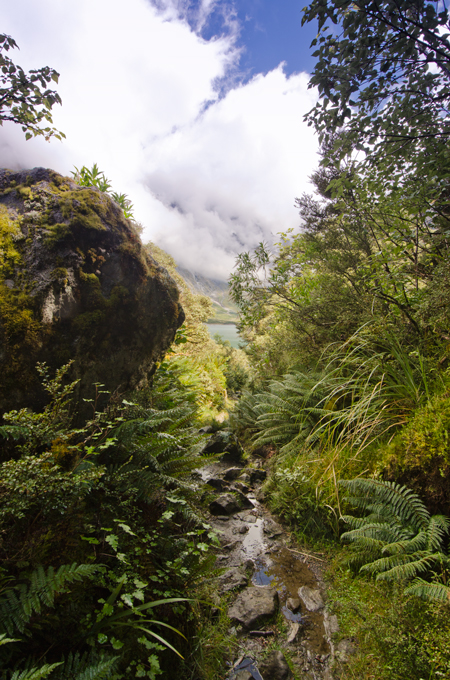
On the Island are 2 hikes, both of them start close to the landing site by research station, from there on; for the first few meter you need to pass sea lion colony, usually the seal are very relaxed and sleep. One of the walk is a 3 hour return broad-walk very easy to do, which winds up to a higher altitude, you pass wetlands, small forest and rata trees. Yellow eyed penguin’s nest very close to the broad-walk, and are not shy by passing tourists as long they keep a safety distance of a few meter. All the way long the scenery change, to take a look back to the harbour is magnificent. At the far end is a small rest area, which invite you for a while to stay and have a snack. From that point the second longer walk turn off, and it takes around 5 to 6 hours back to the starting point.

The walk follow the cliff line, and pass many different fauna and landscapes. Albatross nests in December and early January, Elephant Seals are playing on higher altitude in the fields. As we took our lunch break one of the seals came very close to check out what is happening in his isolated area, it was a great experience to see the seal that close, not more than a back pack in between us, the seal was nearly the same high than me as he stood up on his flippers. But soon he lost his interest and he turned around and disappeared in the high grass. We continued our walk close to the cliff the view from there is overwhelming, the look down to the roaring sea open a variety of rugged rocks and dancing sea weed in the water, the swell was very thundering as soon it hit the cliff and the waves look like he explode in all directions with thundering noise. We took a rest in the sun in an open area it must be the location where the Derry Castel sunk in 1887, a monument remind to that tragedy that time. Soon we continued our walk through high flex and toi toi, on that part was no marker just we knew that we need to keep left and leave the forest on the right; it took some time to walk through that area. But we needed to turn back few times and look for a new track, all the tracks are made by seals and penguins, and going in all directions.

Penguin and seals are nesting in the overgrown area, if you get to close both animals make some noise, as a warning before you get to close.

After we walked through the flex we passed an open area from there we could see already where we need to go, we passed a beach, walked through an forest I never seen before.

Our last few meter back to the starting point where the most exiting for me, we need to pass an elephant seal colony.


Wilderness is an unforgettable experience


Exploring Mt Aspiring National Park is an unforgettable experience with striking landscape formations and bush lines. Mt. Aspiring is located to the South West of Mt. Aspiring National Park. It has a World Heritage status. The wilderness of Mt Aspiring has attracted many outdoor lovers over the years. Outdoor activities like hiking, bouldering, climbing, fishing and cycling are the main targets for many to visit the untouched place. In Wanaka, Mt. Aspiring National Park is well signposted and it is easy to find the way.


On the way out of Wanaka, the Top 10 Holiday Park is just located next to the road and is a very nice place with a great view to Lake Wanaka and the surrounding Mountain.  At Glendhu Bay, there is a typical Kiwi Style Camping Ground which is very busy through the summer month. By Kiwi Campers the privilege of this camp site is to have direct access to the lake and has a boat ramp to lunch the boat into Lake Wanaka. Just a few kilometers away from Glendhu bay is a turn off to west Wanaka Rd, if you take this road it will lead you to West Wanaka Station. There is a DOC car park the perfect start to explore the west side of Lake Wanaka, this location is a good place for fishing in the pristine waters.


To travel from Wanaka to Raspberry Creek is a good day encounter with enough time for a rewarding picnic beside the slow flowing river Matukituki. As we are back to the Wanaka, we take a right turn at Mt Aspiring road towards the mountains. From this part of the road is the road into Treble Cone which is already visible to the left. The first attraction is Diamond Lake, a small lake imbedded into a harmonic landscape, and toitoi.


On the last meter on tarmac is the turn off to Treble Cone. The road is in a good shape to drive up to the Cornet Peak ski lift, on top is a starting point for hang glider on warm days is a very rewarding thermal wind which gives the hang glider a good lift into higher levels. Standing at the car park of Ski lift is an awesome panoramic view to Dunstan Mountains, Lake Wanaka and East of Otago.


Back to the Wanaka, we take a left turn at Mt. Aspiring Road and a yellow signpost signals the start of the Gravel Road for next 40km, the gravel is very loose some times and many pumps are on the drive way which can make the driving exhausting by too less speed. However, the braided river valleys, native bush land, alpine meadows with relaxing sheep’s and cows rewarding the drive into the dramatic Southern Alps.


Short after Mt Aspiring Station is the first Ford Crossing usually it look more dramatic than it is very settled underground and easy to drive through, from that point the scenery get better and better, the road follow the braided river valley, with many romantic places to camp or just having a rewarding picnic beside the relaxing flowing river. At the end of Wanaka Mt Aspiring Road is the Raspberry Creek’s car park, with toilet facility. From there, it starts up the day with a walk into the national park. It takes around 3hours for a return trip. For more adventurous individual, you may start the multi day hike back to Glenorchy. Remember not to litter the countryside and to take all the rubbish back with you out, and leave only your foot prints behind. This is for the effort of protecting the beauty of our nature for our Children.


For more information about activities please refer to DOC office in Wanaka and to find out more about the latest updates about the area.


Department of Conservation


Lake Wanaka Area

Office
PO Box 93

Lake Wanaka

New Zealand.

Ph +64 3 443 7660      Fax + 64 3 443 8777

mailto:mtaspiringvc@doc.govt.nz

Lake Marian

Lake Marian is a lake in the Darran Mountains in the hart of Fiordland National Park in the South of New Zealand.

If you have no transport option from Te Anau www.tracknet.co.nz is the best choice to get to the car park at the entrance to Hollyford Valley. From there it take a 1.5h walk to the lake, after around 20 minutes walk you get the first glimpse of the Marian Creek which is a good oportunity for a short photo stop.  From there on the track is well marked and sometimes you have to pass gravel pits. The tramping track is not very challenging, in dry conditions, after heavy rain it get very dirty on some section of the track just before you get out of the forest.

If you like camping in the nature this is the best lace to be.