Category Archives: Motorbike Tours

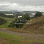
French pass New Zealand

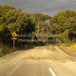
It was already end of January, that I could take a few extra days off. That was a good opportunity to fly to Auckland to relocate my bike, which is still at my storage unit. In total I have had 9 days to travel 2.300 km in total. My plans where to finish road 51 from Napier to Masterton. And ride French Pass.

The forecast was looking very good for the whole trip, after I departed from Auckland I headed to lake Tutira. Was easy ride on a state highway, nothing special. Lake Tutira is roughly 1h ride from Napier and has a freedom camp ground, which is located beside the lake, it was alredy dark when I pitched up my tent. Next morning I woke up I a stunning location. Short time after get ready and packed up my gear I headed to Hastings to get on road 51 to Akitio, a small village beside Pacific Ocean. At low tide it is a good location to try your luck to get some fresh paua I got 1 and it was as big as my hand, tose night I cooked a luxurious pasta paua dish. It was said that cray are around to from time to time, but I haven’t had enough time to stay longer to try my luck again. My ferry was booked already and I had still good distance to travel to Martinborough next day. That was my last day on north island.

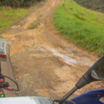
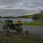
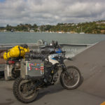
I cached late Saturday and stayed at Picton for the night. On that night I heard for the first time about Omicron outbreak in Auckland. Following morning I rode French Pass and Bowler. It was a combination of sealed road and metal road, and the scenery was getting better and better, the further I rode up the valley to Bowler. I couldn’t go directly to bowler because it is only permitted for house holder and not for public. I rode same way out to French Pass.

In French Pass is a small shop to get most important supply but twice as expensive than in any supermarket in any town due the remoteness. Ice cream, coffee, some bread everything is available, but has his price tag, long black $6 what is absolutely fine for the location. There is no wifi and mobile reception in village.

changing plan part 2

Sometimes making changes is unavoidable, if there are too many obstacles and hurdles in the way it is best to change the plan that is what I did in January, after I found out that no one was absolutely sure with shipping cost if Brexit is going to happen. That was not an easy decision to make leave bike in New Zealand and put it back into storage. At the end it was a good decision I made. After spending more than 1.5 years in Ireland and working there in a castle as pastry chef I returned to New Zealand. As I want reregister my bike, I found out that my wof has expired, at first, I was very confident that I got my warrant of fitness get done without trouble, I just did my previous wof km 2600 before. In general bike was fine there was just that concern of the engineer with my rear suspension that there is a slag of round 5mm which he though is not acceptable for safe riding on road, and I didn’t get my wof first time.

Now I had to find a mechanic which can replace rear suspension connector, everything was organized to fix, until I got the call from bike shop some of the parts are available but there main part what I needed is out of stock in NZ and eta was not available that time, I tried my bike shop in Germany same information part is not available in Germany either eta 3 weeks from that point. Nearly 8 weeks passed to get parts shipped to New Zealand, bike get finally fixed. It is now late summer already, but weather is much better than last 3 month it was raining snowing and stormy for the whole time not a good time to be riding. I have not much new tours but many new photos of stunning places of New Zealand.

I made a last minute change 4 days before my flight depart Queenstown to Auckland, I decided to freight my bike from Auckland to Queenstown, and I booked a return flight, not only for the time I would spend on the bike. This time it was more convenient and much easier to freight bike from Auckland to Queenstown otherwise I had to take holiday which I need later this year. Everything has been booked. On my day 10, (I work 10 days on and 4 days off);

All looked good so far despite we experienced heavy rainfall, thunder, lightning and galeforce winds, road is closed due to flooding on more locations that we get next road status update by 1.00pm. it didn’t got better rain got more heavy and we had to evacuate wharf, and staff accomedation. That all staff had to take some belongings they need to stay for the night on the boat, that is the safest place that time, because Cleadau river grow to a raising torrent no one know if the bank will hold and if in worst case scenario the staff accommodation would be flooded.

A big part of the road has been washed out too, worst of all the road will be closed for the whole week!!!

I have had to cancel my flight again.


northisland

Finally I did travel whole New Zealand, covered more than 75000 kms most of them I traveled on South Island. There is still one area which I didn’t explore and that is northland, upper part of New Zealand. For last 8 month I had my bike in storage as long I have been on Chatham Island for my summer job. Bike soon for the whole time, had no wolf and insurance, first thing to do get the bike legal back on the road, I was not sure if my bike fire up right away, after 8 month standing in storage expected to charge battery first, but any way I give try before taking battery out to recharge, what a surprise bike fired up without trouble. Wof (warrant of fitness) took 5 minutes and I got my sticker that bike is save to ride.

On my first day t traveled to sheep island a nature reserve which is controlled by Auckland council. Don’t get surprised by the first impression it look more than high security track than a reserve. It is worth to stay there for a few days, because one of the endangered birds living there the Takahe they are a bit bigger than Pukeko. Later that day the ranger showed up and informed all camper that whole northland expect a severe weather warning with more than 200mml rain over night, some camper moved on other stayed, I stayed. Rain was hammering over night on my tent, with ear plugs I couldn’t hear much and have had a good sleep. Next morning the whole camp looked like a paddle of water barley any “try” pitch, except where I put up my tent. I stayed for two nights until weather cleared up. My next stop is Otamure bay a DOC camp ground by my check in the lady want sell me a bin bag for $5 which is apparently compulsory the bag was that big that could store my whole belongings on the bike, however I asked her if she is serious about the dice of the rubbishy bag, and for 1 apple would be the rubbishy bag a bit to big, if she could provide a bag which is more suitable for an apple, I was not sure if she felt offended or not but she took the rubbishy bag back and didn’t charge me $5 for it.

On the way up north is an historic Kauri Gum field, Gumdiggers Park on Heath Rd. The park is well presented with many old relic displayed how kauri gum has been digged out.

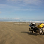
My next stop was Rarawa Beach, it has easy access to the beach good sand to ride on. Just beside the beach is one DOC camp which is nice to spend the night. Following day I rode to Spirits Bay, this was the most beautiful camp spot so far on the north island, surrounded by native bush land and the roaring Pacific Ocean, I stayed for 2 night. This was the first time that it got close to 0C in the morning, and mist covered the whole valley which looked mysterious by the rising sun. As soon sun came through temperature climbed very quickly, by 10 the tent was dried up and ready to pack away. From this camp it was just a short drive to Cape Reinga, usually there are millions of tourists around, that day the northest point was very quiet, what is unusual. I study the tide for 90 mile beach and I was unlucky low tide was by 3.00 pm it was 10.30 am as so many times I hade to adjust my plan not taking the first road to 90 mile beach due the high tide, but visited the biggest sand dunes in New Zealand, from there I took an other back road to Utea Park, even a good place to spend the night just beside 90 mile beach. From there is one more access road to the beach. Now the time was right, the tide was low and I had the chance to ride down the well known 90 mile beach. To be absolute frank the beach is better to ride the some roads in Nz not a single pothole. I felt a bit bored at the end.


Raglan to Waitomo

This time I realy have to say I go where the road takes me, I have not a specific destination in mind, all I did was checking on my map for gravel roads around west side of Hamilton, too all my surprise I ended up at Raglan, one of the top surf spots on the coast close to Tasman Sea, nearly everything is involved into surfing and the locals are very easy going and relaxed. I found a BBH hostel with sea view, and the local Police station is opposite the Hostel located, was not sure if that was purpose or just a coincidence. In total I stayed for 3 nights and it was always organiced from the Hostel onenight movie night, 2nd night Quiz night on my last night was a home baked pizza night it was great fun for everyone.

First day was wet as; and the sky was pouring down as much rain as possible, I took a day off riding and just relaxed by the warm open fire in the living room, what payed off the next day forecast didn’t look good for the whole day but much better than the day before, after breakfast I decided to take the chance for a ride, down the coast.

I passed the main bridge in Raglan to Wainui Rd, from there I continued to Whaanga Rd, from there start a metal road (gravel road) above the coastline. Sea was not too rough and many surfer had fun in the on rolling waves. On the way are many great look out, one of them is directly above the dropping cliff.

I continued to Kawhia, for a coffee stop, after i left I took the backroad through the forest and mountenious terrain to Waitomo. At Hauturu is the turn off just in a right bend I took a sharp left turn onto Hauturu Rd, which is going through prestine scenery with many little farm to the right and the left, the further I went up the mountains the more interesting got the landscape. Every thing has combined in this location, green overgrown hills, dense native forest, and many landslides. At Waitomo I took one more short stop to look for the road back to Raglan. It was already around 3.00 and day light is for another 3 hours I didn’t had much time to explore more of this extraordinary area. I took the fastest way back that was SH31, I just made it before it got dark and on time for Pizza night.

Coromandel

My summer season in Doubtful Sound has finished in late May, just the right time before it get cold and snowy. This time I decided to move on to warmer locations in New Zealand direction; not exactly known wherever the road takes me.  Shortly after my seasonal contract finished I started my trip to North of New Zealand, passed scenery and city’s where I have been before and old memories came alive. From Picton I had to take the ferry to Wellington, from there I rode straight to Coromandel Peninsula where I stayed for nearly two  weeks, it is already late May and off season, this is the time time of the year when it is not very busy, all accommodation is much cheaper than in the summer month. Mostly I stayed in BBH Hostels on my trip, never had a bad experience, my bike was always in a secure location  parked overnight or even locked up in the yard by the hostel. I did some camping too, however nights got very chilly already and in the morning was some condensation on the  inside of my  tent, as soon the sun came out the tent dried up very quickly mostly late morning I took off to my next destination.

Coromandel Town is a good starting point to ride to Port Jackson, on the way I stopped one more time at Colville for one more night camping at Colville Bay Motel it is a unique place to stay, it is very basic for camping but everything is around what you need, the owner are very friendly and welcoming. Next day I started a bit earlier than normal, to ride to Port Jackson it is a unsealed road in a very good condition, more to look out are the local driver they are speeding up and down the road. At Port Jackson is a DOC campground with a Ranger who take care and look after the area. After this visit I went to Port Charles, it is a very rural location, but mobile reception is available, and it is very good for fishing from the wharf, it didn’t took us a very long time after we cast, we caught a big snapper big enough to feed a whole family. The way back to Coromandel was as exiting as the rode I rode before. The hills are very steep and overgrown with trees and ferns after each heavy rain shower or pour down many landslides occur beside the road, I passed landslides they where big enough to cover the whole road from one side to the other, but road worker where as soon at work, as the rain stopped and it was safe to dig out the road from mud and trees. In Coromandel I stayed for a few more nights to relax.


Piano Flat and Waikaia Bush Road

I was planning this trip for some time, the preparation was done but the weather was not suitable, the track is very challenging with many unexpected obstacles. The Waikaia Bush road or Whitecoomb road goes from Fruitlands to Waikaia through private farmland and later through DOC land. The road is much easier if you start by Fruitlands and continue to Waikaia. We took Waikaia Bush Road the access is just around the corner by Shingle Creek coming from direction Fruitlands.

On the first 8 km are few farm gates to open the road is in a very good maintained condition. After the last gate DOC land begins and the road is not maintenance, the road is filled up with rain water which could be front wheel deep or only few inches, but the mud in the paddle is very soft bike is drifting from one side to the other, most difficulty is the tyre marks from 4WD cars which can’t be seen at all, then relay to your luck to get through. I cannot recommend to try riding around the paddle, the ground is very soft as well and the tussock very thick. I drove through all paddle it was very slippery. After I managed the last paddle the road got rockier with wash outs, I decided to drive in the washouts which are not very deep, but without any mud, the tyre had a reasonable grip too. On the next section I experienced a lot of rock steps which remained me more riding down a staircase than anything else. The steps were as high as 40 cm and super slippery covered with a very thin layer of mud and gravel. It is possible to camp beside the track and the scenery is very beautiful, there is a swamp on top of the range too. After the 4WD club stuck in May 2016 the last part of the road (on the Waikaia site) has been improved a lot, there are no wash outs or gaps in the road. It is extreme slippery in wet condition. I put on a brand new Heidenau Scout 60 tyre I have had to work very hard to keep my bike on track.


Akaroa Island

Akaroa Island is just around the corner by Christchurch, there are a costal drive and the much longer drive on the main highway. I took both roads first I passed Lyttlton to Governors Bay continued to Diamond Harbour. The road is sealed until Monolau from that village on the road get unsealed with deep gravel was not easy to ride with a heavy bike, the further I got into hill side the more the road looked like a 4 wd road, unseals slippery and full of pot-holes. The whole scenery is very beautiful and changes many times, all the time a look out offers a great view to the costal area. The road gets connected to Little River. I took a sharp left turn on SH 75 and drove to Onawe Pa, it is historic place to stop singed in 1832. Nowadays it is a Hotel and Restaurant with a view to Barry’s Valley and Barry’s Bay. There is only one road to Akaroa. Akaroa it self has a strong French influence from the past. Many street names are in French, to police station get called Gendarmerie too. At the far end of the road is a Hostel located a good place to relax, in middle of the forest and mountains, far away from the township. Akaroa is famous for fresh fish, French style baked goods and salmon farming.

After my visit to Akaroa I drove to French farm a small settlement at French Farm Bay it is well signposted on the main road and a good opportunity to go for swim water is crystal clear. From there on I followed the road up into the mountain, a typical 4wd road what I found out. The luck with the weather was not on my side, far up in the mountain clouds moved in very fast and the wind picked up my visibility was not more than 10 meters. That contrition continued the whole road up to Mount Bossu, there was a sharp right bent. The weather changed completely, clear blue sky and sunshine was my reward, and I can say that much it was worth it to keep on going. Landscape got better and better, it was time for afternoon tea too. To sit in the field to relax was awesome no notice was around just plain nature. Following Bossu Road to Reynolds Valley is an easy ride, the road is following the ridgeline, and soon the road is going to Kinloch and Breitmeyers. It took only few more meters to go until back on the SH74.
The colonization started in early 1800 at Akaroa Island, it was the same time were the French established in the Pacific region. Approximately 50 to 60 whaling ships were sailing between New Zealand and France. The Wale trace was very lucrative that time; Oil lit street lamps in Paris and other big city’s all over Europe.

However just one month before the Comet de Paris left France, the British signed the treaty of Waitangi with the Maori Chief, at the bay of islands, on the 6th February in 1840. Just 1 month later the Southland Chief of Maori signed the treaty, on 30th May the same year.

The unknowing French arrived at Akaroa Island in August 1840 and discovered they would be settling into a British colony. After the signing of the treaty, a British warship had sailed to Akaroa and planted the union jack. The land had been bought by Langlois had been sold again, as it was often Maori Custom. The British Settler stayed calm, due to much diplomacy that time, no major incidents has arise that time. The French Government requested the British Government to protect the rights of the French landowners in New Zealand, and that was agreed upon in 1841.

Langlois returned to France in October 1842, with a cargo of more than 1.700 barrels of whale oil.

The French settled as planed in Akaroa, but instate a large French colony, just 2 towns had been build with around 60 French inhabitants.


the branches road and station

Near Skippers Canyon by Queenstown is an other beautiful remote 4wd road called The Branches Road. Historically Skippers Canyon was the main area for gold mining in the late 1880, At first was Skippers Canyon Road build and few years later begun the building of The Branches Road. I rode both roads many times and both roads are a great adventure all the time, special on a Adventure bike. Before you reach turn off to Branches Road you have to ride Skippers Road which is at some sections a very scary road, the road follow few hundred meter above Skippers Canyon River, there is even not even enough space for two cars to pass each other, I need to watch out all times for dust clouds which where man made by buses or 4wd trucks, that I could look for a safe passing area to pull in. After I reached the rock fall area there is the turn off to the Branches Road to the right into the forest. The road is very exposed, sandy and rocky; what make to ride my bike much more difficult. As soon I reached the first hard right turn I saw a statue which is overlooking Skippers Town and upper skippers canyon, it was said that the statute is looking for the luck and safety for the gold digger.

From that point on the road get more spectacular than Skippers Road before. The road is more exposed and the cliff is getting higher than on the first part on Skippers Road. The excitement get more and more the further I rode down the road, I passed many fords which where not to difficult to pass, due the luck of rain, one of the Fords was just wheel deep but very big rocks where in the drive way a steep sand ramp was to drive up straight after the ford, my bike begun to swing from right to left, but I got my bike back under control with out coming off it.

Further down the valley I found a green area in middle of an forest which I juice to camp for the night, as a farmer told me it must be the historic supply house on right side of the river, it is the only access to the left side of the river by using a flying fox too, the flying fox is in top condition and get used nowadays. We started pitching up our tents and light up a bone fire. But as soon the day light faded away, little blood sucking animals which we call sand-fly’s make our pleasant first stay very unpleasant. But any way; we didn’t break down our campsite and enjoyed our BBQ and our night. In Early morning hours some animals where running around my tent I have had no idea what kind of animals that could be, after one of them attacked my tent I went outside and checked out the situation. Surprisingly there was no danger at all, there where many rabbits playing and running all over the green, one of them must slip and roll over and bounce back from my tent. It was a great experience to sit on the side and look at the rabbits, what a great start into the day, it was so peace full, around us.

After Breakfast we continued our adventure ride to Branches Station, one section was more challenging, rocks as big as footballs; drifting sand in between them make the passing more difficult. That part is only passable by low water of the river, on a bike. That is the only part of the whole road which can make the ride an obstacle. After our success full passing it was easy going until Branches Station. Many confusing notes where at the entrance to the station. We dried to find the farmer to get permission to go further up the private road, the farmer was so kind to give us permission to continue our ride, he recommended to take the steep gravel road up to the top of the hill. From there we would get the best panorama view over the whole valley. Once more a steep climb smaller and tighter serpentines than ever before, may more suitable for a small 4wd car than for a full loaded adventure bike, we went that far already and no one of us want turn back with out that promised view, it must be a gradient of 45 degree, tough, no way back… keep going and don’t look back down.

The view was incredible, stunning, mind blowing and overwhelming. The only big disappointment was I didn’t ask for permission to camp at this location. We took the same way out of the valley as we took in, every ting seems to be easier than before, but wasn’t. We stopped at the original Skippers Home State to take a close look of the well maintaineced cottage, historic tools where hanging outside and where displayed inside as well, an old iron bed was on the far end of the room the fire place was nicely set up with pans and kettle.

May Queenstown is called Adrenalin capitol of New Zealand, definitely Skippers Canyon and Branches Road is Adrenalin capitol of Queenstown.

There is one more good rule on those roads, the road is not suitable for camper vans at all, and if some one rent a car, this is one of New Zealand roads which the rental company exclude any insurance. In the whole valley is no cell phone coverage, if a break down happen it make it very difficult to find fast help by phone, more likely it is a long walk back to the entrance of the road to make the needed call. Even than it is not certain some one pick you up due the difficulty and danger of the road.


The Branches Station is a high country farm with 90 000ha of farmland, Sheep and cattle are the most livestock which is on the farm

There is a chance to stay at the branches by one of the farm houses , which is called Stockman’s Camp, to experience that unique and pure, untouched environment cost its price.


guaranteed wet feet

There are not many country roads left on the South Island which I didn’t ride on, on my Adventure bike. It took some time and a lot of research to find the right initarary to combining all back roads I want to do into one round trip which start in Milford Sound and end in Milford Sound.

As I can remember I left after work, weather was not good at all rain in Milford Sound, road restrictions are issued around the Homer Tunnel, road was going to close at 5.00 pm due to heavy snow fall over night, which is not common at this time of the year. Despite the driving restrictions I took off, to make my way to Te Anau my first stop to buy food for next few days, after I did all shopping and refilled my bike, I drove to South-arm of Lake Te Anau. I toke the state highway to Manaporie and from there I followed the Scenic signage to Tuatapere, at Blackrock Station is a turn off to Borland Lodge, there I take a right turn and follow the road, first 9 km are tarmac the remaining km is very good gravel to ride on; around 60 km one way. At the south arm is a DOC camp ground in the middle of the forest, I juice to camp in an open area beside the Lake with a magnificent view to the mountain and surroundings of the lake, I have been very lucky that night to spot a deer, which disappeared very soon into the thick dark forest.

I woke up early in the morning to make my breakfast and get ready for my next destination Invercargill. As soon the air warmed up the sandfly got more and more, I broke all records to pack up my gear on the bike, it has been insane to experience that many Sand-fly that early in the morning.

In Invercargill I booked a BBH Hostel, Southern Comfort it is very tidy and quiet accommodation. Shopping centre are very close too.

My day 3 of travelling started with loads of fun: I meet two Malaysia girls, Tan and Yunee as soon they found out that I am a chef we did a spontaneous cook off, in the kitchen of the Hostel; it was the best start into the day, after we finished our breakfast we took or own journey to different destination. Some how I felt sad to leave so early; but I need to get to my next destination Purakaunui Bay Road, at the end of the road is a DOC Camp, which I would say is one of the nicest I have been so far. In Fortrose I turned right to avoid the main road in direction Otara, the road is very narrow and unpaved, there are so many look out spots which have not been mentioned in any travel guide which are breath taking, with a magnificent view to the rugged coast line. My next morning started early, I broke off already by sun rise already to drive up to Waikouaiti were I took the Ram Rock road to Middlemarch. As soon I turn onto the Ram Rock Road the gravel started, I meet some farmer beside the field which was a good opportunity for a small talk about the area, kettle and sheep farming is the most income of the farmer in the are. The winter month I could be very harsh due to very cold temperatures and gale force winds which could be very destructive to the native fauna and flora. The road was very easy to ride on, not a big issue. My original plan was exploring Lake Onslow Road, the weather turned, to be very bad, wind picked up to make a save bike ride nearly impossible, to all my surprise it started snowing, it was already early summer, I reached Clarks Junction, where I stopped and had a hot drink to observe the black clouds rolling over the area I wanted to go, once more I need to make a decision if I want continue my original plan or turn around and look for a alternative route. Even the barkeeper suggested to avoid the Lake Onslow Road, ant look for an alternative, If I would continue my original plan I need to take Serpenine Road that road is in a very different condition, not maintaineced for many years with very deep mud pools, rain water which is filling up mud pools could be wheel deep. At the end I decided not going ahead with my original plan, and turned around and drove back to Middlemarch than Hyde, Ranfurly to St Bathans. Where I camped beside Blue Lake. Once more it was freezing at night not as cold as many nights before top low was only -2C, now I realised it must be very close to summer. ^_^. As soon I opened the tent I got blown away clear blue sky!!! But a bit chilly. Only one hour later the temperature reached 15C. It will be a good day for adventure riding. One of my friends Klaus told me a long time ago there is a pass from St Bathans to Oramara, which is not easy to ride on a fully loaded adventure bike, I still remember his words, but took off onto Hawkdun Runs Rd from there I followed Broken Hut Road, I loved the ride in the early morning hours, at one stage there is a Y junction left road is going to Omarama Saddle with more than 30 river crossings exposed 4 wheel tracks and very deep river even by low water. I took the right turn there are 6 river crossings only, one of my most difficult crossings at all, are river 3 and 4, big stones and an uneven surface make the crossing very challenging. On river 4 I need to got off the bike and pushed the bike through the rocky river bead I the water was more than knee peep. From there on the road is plain adventure, nothing, I could tell was missing, all my bike skills are needed on the next part up to the saddle. Potholes, deep wash outs, from flash floods running down the road and big rocks are only a few to mention, I loved the whole day riding, it is not more than 35 km’s from my night camp to Omarama but it took me 5.5 hours.

On my way to the Y junction I meet Peter and Lesley from Leviathan Hotel in Dunedin, which took the same road, with out them and there help I probably would still stuck in one of the Rivers today.

After such a big day in one of the most sophisticated areas we went into Omarama for a refreshment. I went back to Wanaka my last camping location before heading back to Milford Sound next day. ^_^


4 season in 8 days


This year I start my first tour early spring, the weather could be very dramatic, and unpredictable. Special on the South Island of New Zealand. The day’s could be very nice and sunny or it could be the opposite, snow could fall up to sea level.

However my first day was an absolute brilliant day, with sunshine low clouds over the Fiord of Milford Sound, and very mild temperatures. After I have had a good breakfast and a strong coffee I started my journey to Dunedin it is a 4.5-hour drive. Where my BMW should get serviced, I have had some unexpected delays on my way, my engine cut off many times as soon I geared down. I was experiencing this trouble already before and contacted my bike dealer. As soon the engine was dying all I need to do open the tank lid, close it again and the engine was running with out any trouble. As I arrived at the bike shop it was late afternoon and to late for the service. The next service which would be available would be in 1 week. There was nothing to do to put my bike for the service the next day, the Manager told me, despite I explained him the situation that I am on holiday and travel to north, even if he could do just an simple oil change would be fine for me. He refused. That was not all; the gasket is leaking too, the bike is just 1 year old and has not more 21200 km.

Early next morning I drove up to Christchurch, visited a licensed BMW dealer, which booked in my bike on the next available day, that worked out for me, and I could do some back country riding. After I left Hamptons Motorcycle, my bike’s engine cut off 3 more times, I did what I did so many times before opened the tank lid and closed it, and continued my riding, until next time engine died.

Finally I took the west coast highway to Arthurs Pass, it was just a 45 minutes drive to the turn off onto Lyndon Road, my first dust road after a long winter break. It was a good feeling, to feel how the tyres bit into the gravel. At lake Georgine I found a great spot to pitch up my tent, surrounded by native fern and the mild splashing lake. The night was looking to get very chilly, it was full moon that night, so I light up a little bon fire beside the tent, and eat my dinner beside. Next morning it was freezing cold just below 0C, fresh snow fell on top of the mountains, during the night. After break fast I got prepared and started my journey.

My plan was to visit the power plan Kowhai, Lake Heron, Lake Ophua, and Lochaber. The whole day was very sunny, the temperature reached tropical 8C at midday. The dust road to lake Heron was in a very good condition, I could accelerate to move on. At the end of the road beside the lake is a nice plateau to have some quick lunch, the contrast from the fresh green to the magnificent landscape let me dream away for some time, out of the short break I planed before, was at the end a 2 hour stop. There is only one road in and out of the valley, to Geraldine, suddenly I need the first time in my life my helmet, I never need it before but now I need it!!!!! It started hailing, hailstones as big as a finger nail, all I can say the hail was a hammering on my helmet, hail stopped as quick as he started, but still some extra croton was needed on the road. After I passed Geraldine my next stop will be Fairlie, at Fairlie I turned into Kerr Clayton Road it is the first part of Lochaber Road, scenery up the road is stunning. It was already late afternoon as I reached the end of the road, it get time to look for a camp spot, not far away from the road is a signed camp site at Opuha Gorge, that night will be one of my coldest nights ever, I camped out in the wild once more, there is a cold front moving in from the alps, locals informed me that night temperatures could get very chilly. I did some winter camping before, put on my thermal clothes, I have had a very good sleep, didn’t feel the cold despite the temperature plunged down to 7C below 0C. The bike was covered in frost the next morning. Fist thing to do after such a cold night, cook some water to make a strong coffee, and lean back and enjoy the sunrise.

Already a long time ago I changed my stove, I used methylated alcohol for cooking but changed to petrol, at low temperatures methylated alcohol could be difficult to light up.

On this day I traveled in direction Mac Kenzie Pass, Lake Benmore, Hakataramea Pass and Mayers Pass to Oamaru.

It was a very cold day again, around 5C and sunny. The day was a very easy and relaxing, good gravel road no camper vans or bicycles on the road, there was only one big decision to make which road I have to take to Oamaru, there are two options first one Hakataramea Road which is a back country road with few Ford Crossing, or the more challenging Black forest road, you need to ask the farmer for permission at Black Forest Station to pay a little road tax to him. It took some time to make up my mind, the cold front was still moving in the wind picked up already, it was much rain forecasted, as friends told me before, if I want to do Black Forest the weather must be very good other wise it could be a very challenging adventure more like a mission.

I decided to ride Hakataramea Road which was a good Joyce. Only after a few km’s it started to snow temperature on my GPS 1C not even close to the pass, Snow got more intense on the way to the highest point of the road, for some reason snow shower stopped before I reached the pass, I was hoping to get a nice photo at the pass with some fresh falling snow. All the scenery changed many times from brown landscape into fresh green farmland, all shades of grey, green blue.

Mayers Pass is not a very tricky section; at some parts deep cliff and drop off make it more adventurous. I passed Serphentine Valley, Elephant hill back road. From there I took SH82 to Kurow. There is no Backpacker in Kurow to stay. So I need to booked a Top 10 Holiday park in Oamaru for that night, to get a hot shower after a few days camping by chilly temperatures.

I have had a refreshing beer that night too. Next morning I drove back to Christchurch to service my bike at Hamptons. Despite the service took longer than expected, I started my journey to Lake Tekapo, it was already dark when I arrived there, the wind was exceptional strong for the time at night, the weather change must affect the unusual strong wind that night. I pitch up my tent in the difficult condition, full of a challenge’s, it took much longer than usual. First I started with placing the tent on the ground put the pegs into the ground one by one, the tent was moving all the time was lifting up and twisted around, until all pegs where placed. Next step put pools into the tend tighten all secure straps, and safety line’s on all sites. Surprisingly few of the secure lines get ripped out of the ground by the gale force wind, during the night. There was no way to light up a bonfire, the wind was just too strong.