Category Archives: Motorbike Tours

Skippers Canyon

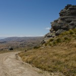
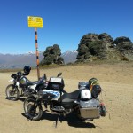
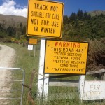
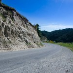
Unbelievable scary, with the beauty of a women; is the Skippers Canyon Road which belongs to the top 10 dangerous roads of the world.

The entrance of the road is in the same location than Cornet Peak Ski fields by Queenstown. The turn off is in a long right corner ¾ up the road to the left.

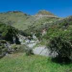
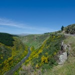
Skippers Canyon road is a historic scenic road 22km in length,, which winds up beside Shotover River one on New Zealand’s richest bearing gold rivers, which was named by William Rees one of the first settlers from Europe.

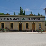
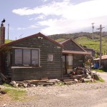
In late 1862 Thomas Arthur and Henry Redfern discovered in the area of todays Arthurs Point 4 oz gold in 3 hours, they made no secret of the found and soon start the settlement up the river. At the early stage of the gold finding the miners had to find there own way up the river, which was very difficult due the steep mountains and the current Shotover River, at this time many accidents and casualty’s has been reported, which had difficulty of the transport of goods to the end of the river. In late 1800 the first survey has been made to build a road into the valley to make the Skippers Canyon more accessible for the Miners, first Hotels where build beside the road one of them was the old welcome Hotel, today are only the both chimney remaining the other one is the Otago Hotel far up in the mountain, not much left of this Historic accommodation, it can be reached by a 2 hour hike or Adventure bike but, there are a few tricky sections with deep steps that make the ride a bit challenging, a good work out for biker to check his menthaly strength, on one side is the straight rock up and on the other side a steep cliff to the Shotover River. However the access point is behind the historic cemetery. Further up the valley, first challenges waited for the road workers, the rock is very soft and the steep cliffs made the road very dangerous, at dry condition as soon the carriages rolled over the loose rock, the rock turned into dust, as soon the rain started the dust road was very slippery and unpredictable. Under those condition it was no surprise that motor vehicles where banned until late 1900, and no insurance covered the vehicle on this road. Today it has changed; Skippers Canyon Road is a public road from start to end.

Today, Skippers Canyon is a main tourist attraction. On weekends the road is very busy with 4×4 wd cars, at some locations it could be very difficult to pass an on coming vehicle, usually by dry condition is a massive dust clouds visible from the on coming vehicle and a passing spot can be looked at, to let the on coming vehicle pass. For UN experienced driver the biggest challenge is the deep drop beside the road, with no hard shoulder on the side. In 1898 the Skippers suspension bridge where build in just 2 years. Even though the completion of the existing bridge was done after the gold rush was over, it is one of the main attractions of the journey to Skippers Village. The bridge spans from sheer rock faces on both sides and is about more than 100m above the Shotover River.

At Skippers Town village is a DOC campground with basic facilities. The old school house is nicely refurbished and one of the original houses is open for visitors to take a look into the basic live in the gold mining times.


Old Dunstan Road

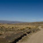
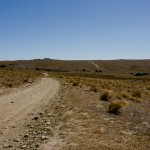
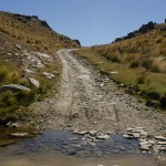
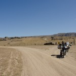
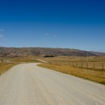
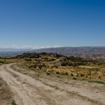
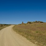
This is one of my favorite Central Southland routes, on a clear sunny day the road is absolutely heaven for adventure riding. It can be done on a rainy day too but the road will change into a single mud track. I have done the road on both conditions and had at the end a big smile on my face despite the rain and mud challenged me to keep the bike up. The difficulty by wet condition is that the rain fill up the road and it is possible that the water level is front wheel depth. Underneath the water is the original track which is heavily used by 4X4 cars, and the cars left big drive lines behind which are not visible from the bike so the risk is very high to slope and slide to the side in the middle of one of the mud pools and drawn down the bike. But by dry condition the track is fine to ride, there are few passages which need extra care since flat gravel is very loose on the driveway the bike could slip on those medium size flat rocks, especially if you travel down hill.


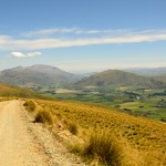
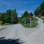
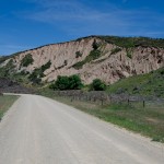
My journey started in Alexandra and I drove up to Galloway, from there I turned onto Crawford Hills Road, where the Gravel road begins. It is a very well prepared road with some nice lookouts on the Dunstan Mountains and North Gough Ridge. The Old Dunstan Road is just a short drive from this point and it is sign posted on Old Dunstan Road or Poolburn Reservoir. The scenery changes from now on many times beside the road pile up rocks and pillars which are very impressive.


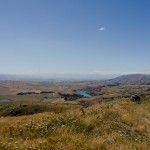
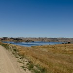
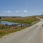
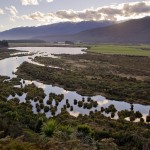
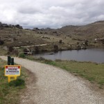
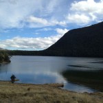
My favorite camp spot is above the Poolburn Reservoir, with a great 180 panorama view, by day and night. Just few kilometers up the road is the first gate, from this part of the road start private land, please stay on the track because the environment is very fragile. After the second gate is a junction if you go to the right you get access to Long Valley Ridge Road which is connected to Serpentines. I decided to stay on the road and drive to Linnburn runs. There is many livestock on such as sheep and cattle, the road is very exposed and steep.


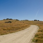
The Linnburn Runs is the first part of the Old Dunstan Road, follow the sign post Paerau which is a historic settlement, remaining of the Styx Jail and the Historic Hotel dated back to 1861 are a good opportunity for a short stop before continue the second part of the Old Dunstan Road. The road is like a highway on gravel, but not a single pot hole or bump. First highlight is just after the first crossing of the upper Taieri bridge, an old grave yard which is dated back to the time gold has been discovered in this time around 1861.  The highest point of the whole road is around the next corner of 918m.


There is one more lake to come Longburn Reservoir, even though it is close to the highest passing point of the whole road it is a good place for camping out before continue to the next day’s journey to Dunedin. The whole road is about 190km off road with different kind of landscapes and changing sceneries, however there is no washroom along the road for a comfort stop.


Actually, Old Dunstan Road will be closed in the winter month from 1st June till 1st October. I highly recommend this trip and do some amazing back country camping, to do the whole road over 3 days is really worth it!

Borland Road

Borland Road is the only road access to the South arm of Lake Manapouri.

Construction of Borland road begun in 1962, to enable to service the Power line from the Power Station on Lake Manapouri. Today the road is important to outdoor enthusiasts. Many tramps start beside the road or on top of the Borland

Saddle, even a camp spot is set up with toilet facility’s.

The access point is in between Clifden and Manapouri just north of the Blackmount school, a bus shelter is beside the access road.

The road condition can vary from the weather condition, in winter month it is possible that the road is closed by snow fall. A round trip from Te Anau to the South arm is around 180 km 90 kms are unsealed road but very easy to drive no river or ford crossings for the whole distance.

An ideal pick nick spot is the south arm very idyllic and romantic to watch the sun set at lake Manapouri, a camp spot and some toilets can be found at the end of the road.

Please remember take all your rubbish back out and leave the place as you found it untouched and leave only your foot prints in the sand as remaining you have been visiting this place.

There is one accommodation at the Borland Road, the Borland Lodge. In the summer month the huts can be fully booked by school classes and groups.


Macetown

Macetown is a historical gold mining settlement in the Arrow Gorge, situated far up in the Mountain.  The access can be found in Arrowtown by the car park which is close to the Chinese village.


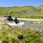
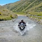
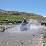
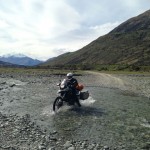
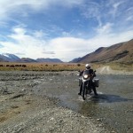
This settlement can be reached by foot, bicycle, and Motocross bike or 4wd vehicle. The road crosses 22 times the Arrow River and creeks on a distance of 15km. Over the past few years the road has not been maintained on some sections so the road is very rough with deep drive ways. The most river crossings are by the first 3 km’s drive ways of the 4WD vehicle. The water could be 1/2m deep and the underground is very loose so be careful if you cross the river with your bike and check the tire pressure first before driving through the water. I drove beside the drive way and the water was much shallow and the only difficulty was the hidden big rocks along the waterline. I drove slowly and then increased the speed by driving out of the water. It is safer to stand than to drive seated. This is due to the fact that in a standing position, the bike can be much better controlled and balanced if you slip. This is just in case you come off the bike by the river crossing. It is much easier to balance the bike if the engine happened to turn off.


On the way back to Arrowtown the sun stood behind us and the river was like a mirror. There was nothing to see what was hidden under the waterline. The only way to find out was to get off the bike and walk through the river to find a good line to pass. At some parts close to the end of the river side, the water was around 21 inch deep although we have had no rain for around 3 weeks. Before going up the mountain, I advise to check the river current if the rain drop in the river rises rapidly then a crossing could be impossible than before.


History of Macetown is dating back to 1862 when William Fox discovered gold for the first time in the Arrow River. In a very short of time the population of the little township grow up to 1500 miners at the junction of 12 mile creek. By 1865 most of the gold was excavated by the miners and the population shrunk rapidity.


At the early 1900 the town was deserted, only a few original building are restored and one of them is the Baker house. This is the first building visible of the historic Macetown. Department of Conversation has successfully restored those buildings over the past few years.


Macetown had a small Chinese community, which was based by the end of the main street in the area known as Chinatown. The Chinese miners kept up the Chinese tradition and celebrated all annual events such as Chinese New Year and moon light festival.


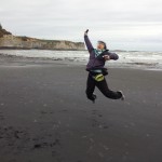
My verdict of this trip is highly recommended for Motorbikes up to 650 ccm, with a huge fun factor, I have not been such exhausted before for a long time after this trip. At the end, after 44 river crossings I just dropped my bike to the side then switched off my engine although the back wheel still in the water. I lifted my arms and shouted I made it safe and dry! it was such a great day! Once more I had experienced in the most amazing part of the world in the rural untouched back yard of Southland 🙂


A road with more than 15 gate to open or close

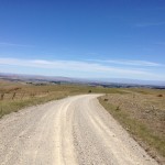
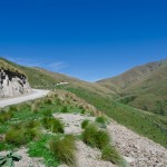
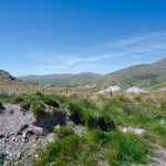
The Thomson Road in the Dunstan Mountain is a historic road which is open year around in the summer time is a 2 WD road while a 4WD in the winter month. It is a remote high country road where some examples of early gold mining and early settlement in the Dunstan Mountains are discovered.


This historic road follows beside Thomson Gorge Creek with a few ford crossings. By dry conditions, the fords are half wheel deep, but very rough to ride through on a motorbike. The easiest access is the turn off by Lindis Crossing. The turn off is just before the left turn onto a bridge to the right, driving direction from Alexandra to Tarras.


In late 1862 the first miners were crossing over from Manuherikia Valley to upper Clutha Valley and discovered gold in the river. The Thomson Gorge track was used by miners and traveler who made their way to east or west.

There are many historic sites beside the track, most of them are on private land. Visitors should respect the privacy of the land owner and should ask for permission to enter the land before trespassing.  If access is denied there is a good reason why the land owner denies the access.


The road is very easy to drive in dry conditions and by rain there are not many rough sections along. The only big challenge is to open or close the gate on the road in total there are 23 gates to open or close! Jumping off and on the bike keeps you busy and it takes longer than riding the whole road from east to west. The roads winds up into the mountain over the Thomson Saddle (900M) into the Bendigo area on the eastern side of the range. Not far away is a stone hut build beside the road in 1908, which provides shelter to the traveler on the way to the goldfields.


On top of the Saddle is a magnificent panorama view into the Southern Alps and lake Hawea, Lake Wanaka, and upper Clutha. I have not found a good camping spot beside the track yet. The underground is very rocky, or live stock is around, mainly sheep. The valley is very wide and it changes the scenery more times. Many picnic areas are located along the track so remember to take your litter home with you.


Wilderness is an unforgettable experience


Exploring Mt Aspiring National Park is an unforgettable experience with striking landscape formations and bush lines. Mt. Aspiring is located to the South West of Mt. Aspiring National Park. It has a World Heritage status. The wilderness of Mt Aspiring has attracted many outdoor lovers over the years. Outdoor activities like hiking, bouldering, climbing, fishing and cycling are the main targets for many to visit the untouched place. In Wanaka, Mt. Aspiring National Park is well signposted and it is easy to find the way.


On the way out of Wanaka, the Top 10 Holiday Park is just located next to the road and is a very nice place with a great view to Lake Wanaka and the surrounding Mountain.  At Glendhu Bay, there is a typical Kiwi Style Camping Ground which is very busy through the summer month. By Kiwi Campers the privilege of this camp site is to have direct access to the lake and has a boat ramp to lunch the boat into Lake Wanaka. Just a few kilometers away from Glendhu bay is a turn off to west Wanaka Rd, if you take this road it will lead you to West Wanaka Station. There is a DOC car park the perfect start to explore the west side of Lake Wanaka, this location is a good place for fishing in the pristine waters.


To travel from Wanaka to Raspberry Creek is a good day encounter with enough time for a rewarding picnic beside the slow flowing river Matukituki. As we are back to the Wanaka, we take a right turn at Mt Aspiring road towards the mountains. From this part of the road is the road into Treble Cone which is already visible to the left. The first attraction is Diamond Lake, a small lake imbedded into a harmonic landscape, and toitoi.


On the last meter on tarmac is the turn off to Treble Cone. The road is in a good shape to drive up to the Cornet Peak ski lift, on top is a starting point for hang glider on warm days is a very rewarding thermal wind which gives the hang glider a good lift into higher levels. Standing at the car park of Ski lift is an awesome panoramic view to Dunstan Mountains, Lake Wanaka and East of Otago.


Back to the Wanaka, we take a left turn at Mt. Aspiring Road and a yellow signpost signals the start of the Gravel Road for next 40km, the gravel is very loose some times and many pumps are on the drive way which can make the driving exhausting by too less speed. However, the braided river valleys, native bush land, alpine meadows with relaxing sheep’s and cows rewarding the drive into the dramatic Southern Alps.


Short after Mt Aspiring Station is the first Ford Crossing usually it look more dramatic than it is very settled underground and easy to drive through, from that point the scenery get better and better, the road follow the braided river valley, with many romantic places to camp or just having a rewarding picnic beside the relaxing flowing river. At the end of Wanaka Mt Aspiring Road is the Raspberry Creek’s car park, with toilet facility. From there, it starts up the day with a walk into the national park. It takes around 3hours for a return trip. For more adventurous individual, you may start the multi day hike back to Glenorchy. Remember not to litter the countryside and to take all the rubbish back with you out, and leave only your foot prints behind. This is for the effort of protecting the beauty of our nature for our Children.


For more information about activities please refer to DOC office in Wanaka and to find out more about the latest updates about the area.


Department of Conservation


Lake Wanaka Area

Office
PO Box 93

Lake Wanaka

New Zealand.

Ph +64 3 443 7660      Fax + 64 3 443 8777

mailto:mtaspiringvc@doc.govt.nz

Unlimited Ford Crossing

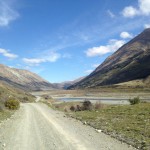
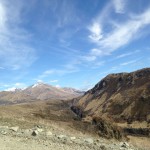
The Nevis Valley is in central Otago, I took the main road to Bannockburn. From there it took only few minutes to get to the main gate into the valley. Then the road ascents for 1370 M to the Nevis Pass therefore the highest public road in New Zealand. There are many photo stops on Carrick Range, to take a look back to Lake Dunstan and Cromwell. It is much better to travel on dry road than the wet one as it could get very slippery. After Nevis Crossing, there are sections with bigger rocks on the road while other sections are very loose with dust. After heavy rainfall the fords rise very fast and results the crossing difficult or impossible from fast current.


On the day I did the Nevis road it was not for a week and very dry, which is perfect to travel on this road. A few fords were still half wheel deep, up to 60m wide. The splashing water was very refreshing, in the intense heat. I loved each crossing! There are a few gates close to Ben Nevis Station which are usually closed but not locked up therefore easy to open and pass with the bike. The valley is divided by steep rocky gorge, the lower and upper Nevis whereby the upper Nevis is very isolated but with breathtaking beauty of the valley. There are numerous remainders of history are on both sides of the road which is worth to take a look at the old cemeteries, or old Nevis Village. They are the remaining foundations and former settlement. As usual it will be very hot during summer time while winter months are very harsh with thick snow in the valley.


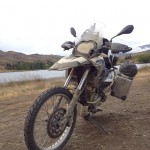
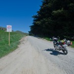
Around 40km before Garston, the road is very rocky and very difficult to ride with a full loaded Adventure Bike of mine. However, it is a very good work out. It is worth to have enough time on this trip as there are numerous camp spots beside the road which are welcomed to pitch up the tent and to stay with the most beautiful scenery of Otago.


I recommend traveling in a group on this trip just in case there is something goes wrong and there is always a support behind. Otherwise, it will be difficult as there is no mobile phone coverage in the whole valley.


The Nevis Valley section from Cromwell to Garston is around 90km long of journey. It took me around 7h to travel included the photo stops and lunch break. If you get on the Sh 6 by Garston, there is a Pub which offers welcoming refreshments. Of course, I will do it again for 2 to 3 days on my next day off. There is too much of the gold mining history to explore!


My dangerous tires

My dangerous tires through Danseys Pass


Today, it takes me a while to consider whether or not to continue the tour from Oamaru to Alexandra via Danseys Pass. Both of my tires are nearly worn out and the road I chose is mainly gravel. I thought the remaining depth of my profile is not enough and not safe for this trip. There was a heavy rain shower the day before, I thought the dirt road may be slippery and the gravel would use up my last bits of the profile. I hesitated until early morning to observe the weather. Fortunately the sun came out, the sky cleared up, then I decided to continue my adventure ride over Danseys Pass Road despite the worn out tires.


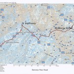
Danseys Pass is located in the Kakanui Mountains between Central Otago and North Otago. The road was very important in the gold mining times in 1880 to supply the miners with food and liquor from Naseby or Ranfurly. After the gold fields were exhausted then the settlement went into a ghost town, but Danseys Pass Road kept well maintained until today. It is a public road but is not recommended for camper van and heavy vehicles.


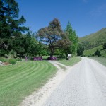
I camped at Duntroon at the sport field which is located on the right hand side if you travel from Oamaru behind the bridge. Camping is permitted however with a little fee. Next morning I went to Livingstone Street which is not far away from the camp ground, by the turn off point is a sign post of Danseys Pass. For the first 14 km the road is tarmac and easy rolling. The scenery is awesome with so many greenery fields alongside of the road. I came across Pukeraro on the way. The campsite at Pukeraro is an idyllic site but fully equipped with all comfort for the travelers. If I would have known this camp earlier then I would have stayed there for my first night.


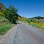
It was a hot roasting day as there was no rain and that explains to the dry and dusty road. The further I traveled the narrower the road got. The road follows the river flow sometimes the mountain got straight up beside the road; the vegetation is all the time green with many different flowers and bushes. I loved the scenery all the time because it changes many times that helps for my eyes and keeps me awake.


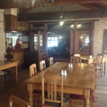
As I arrived at Kyeburn Diggings, I stopped by a historic Hotel which was built in 1880 and is opened for public. Danseys Pass Coach Inn is very isolated whereby the only place that I get to meet up some people in my tour so far. When I entered the lobby I realized very quickly that it is a place with a special harmony in between the gold rush history and the modern life style today. Sorry, please don’t get too much excited yet as there is no mobile reception. Otherwise it is a hidden treasure, where you can find good food, all local drinks and even fresh baked cakes are available too. Next time I will do the tour again. I will stop by and stay overnight for sure. But I have had not enough time to stay longer so I continued my tour to Alexandra.


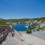
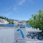
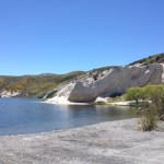
As I have used to travel on SH85, I remember there is a signpost to Blue Lake and St. Bathans which is an old gold town with only a few well maintained houses to accommodate visitors. I drove down to the blue lake located in between white sandstone with a few lonely standing green trees. This time I cooked some food and had a warm coffee. I enjoyed my meal next to the lake under a big tree which provides me a good shade in the blazing hot afternoon. Then I continued my journey to Alexandra and fitted my new tire of Michelin Anakee 2. I have been very lucky to be in time to Alexandra as the gravel has already taken up all my tire profile. Big thanks to the staff in the workshop at Davidson Honda, for helping me to change to new tire. I deeply need a rescue at the last moment.

Invading southern part of South Island in 4 days

4/10/2013 to Tuatapere

First day we headed towards Tuatapere from Milford Sound through State Highway 94. We departed about 330pm. On the way we stopped at Red Cliff Wetland Reserve developed in year 1977. It is a good stop for a panoramic view of the wetlands from top. It is a picturesque area combining Winding River and forest. Our second stop at Clifden Suspension Bridge. It is spanning 111.5m above once the mighty Waiau River remains as a memorial to those involved in the design and construction from 1896-1899. It claimed fame as having the longest span of any suspension bridge in NZ. This bridge is made from concrete mixed by hand and poured inside boxing by bucket and windglass as height grew. We spent the night at Last Light Lodge Café and Backpacker. We were surprised to know that we are the second guest of the lodge.

5/10/2013 to Surat Bay

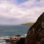
Second day, we had a breakfast at Yesteryears Museum and Café which is just few kilometers away. This is a privately owned museum of rural Southland history, set in a warm café atmosphere. We were greeted by Helen, the café manager and enjoyed listening to some familiar songs played on old back disc player. In the café aka museum, you will get to see Helen’s collection of green glass and kitchen goods from four families who lived in Tuatapere area, as well as artifacts from the town’s schools, churches and business. After that, we continued journey down towards Invercargill using State Highway 99. On the way we stopped by McCracken’s Rest near Orepuki. It is a rest area that provides spectacular panoramic coastal views from Pahia to the Waiau River mouth and further around to the former timber town of Port Craig. Our next stop is Monkey Island which is not far from McCracken’s Rest. It is a small island and mini lagoon off the southern end of the beach. It is also accessible during low tide, with a small walking track. This rocky knob, which becomes an island at high tide, has great significance to Maori as the anchorstone of the legendary Takitimu waka/canoe which was wrecked in Te Waewae Bay. Monkey Island was a traditional Maori lookout for whales too.

Driving on Orepuki Riverton Highway, we stopped by Cosy Nook. It is a delightful area, including Garden Bay is well worth the visit as the road in reveals a very picturesque craggy cove that today shelters several fishing coats & holiday cribs. Then we moved on to Invercargill town. There, we found “Indian” in Hammer Hardware shop. There are many old motorbikes displayed in the store apart from hardware selling as the main business. We are proud to behold the well known motorbike which is developed by the late H.J Burt Munro from a 1920 600cc Indian Scout. It was officially timed at 308 km/h reputed to have exceeded 322km/h therefore it is claimed to be the world’s fastest Indian.

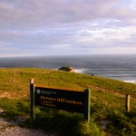
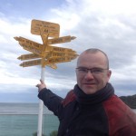
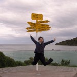
We proceed to the southern-most town in New Zealand, Bluff through State Highway 1. We visited Stirling Point which is named after Captain William Stirling who established a whaling station for Johnny Jones in 1836. Standing like a sentinel at the entrance to the harbor is the Stirling Point pilot station built in 1912. The world famous Stirling Point signpost attracts many thousands of visitors each year. It was originally built of timber. Due to repeated vandalism it was replaced in metal and cemented in place. Today’s version gived directions to 12 locations including Invercargill’s sister city Kumagaya, Japan. After that, we continued journey towards Surat Bay using Chaslands Highway. On the way we stopped by Florence Hill lookout, Catlins. It is near the top of hill on the other side of Arno River. You may view the coastal golden beaches from top. We stayed at Surat Bay Lodge which is right on the beach in the bayside hamlet of Surat.


7/10/2013 to Dunedin

Next day, we woke up early morning to watch sea lion at the nearby beach. According to the lodge owner, there is a specific time to watch sea lion that is about 9am. You may try your luck in the bushes just in case you cannot find them on the beach. Surat Bay offers a rare opportunity to observe sea lions in a natural mainland environment. Sea lions use the sandy beaches to rest, sleep, pup, mate and play. They interact socially each other while ashore. Unlike fur seals, sea lions are not afraid of people. They can move quickly on land and can be playful in the water. However, sometimes they can be aggressive if provoked. We were lucky to observe a sea lion that was resting on the beach before giving up to find one. It was a heavy downpour right after the stroll on the beach. We waited in the lodge for about 30min before continuing.

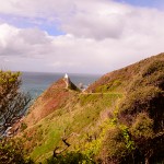
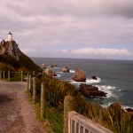
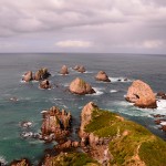
Our next stop is Nugget Point which is located at the northern end of Catlins coast down the road from Kaka Point. This steep headland has a lighthouse at its tip, surrounded by rocky islets aka The Nuggets. The bike ride is a tough one due to the strong crossing wind. The whole bike was shaking wildly before able to stabilizing it. It took us about 3 hours ride to reach Nugget Point. The walking track to light house and viewpoint is about 600m of distance. On the way, we passed the viewpoint of fur seals’ nurseries. The tracks took us about 15 min to reach the light house where the “nuggets” scattered around the sea. It was about 4pm, we continued our journey towards Dunedin (which is known as student city) through State Highway 1. After checking in Elm Lodge, we went to Otago peninsular for sunset. Then we continued to check out blue penguins nearby then noticed it needs admission fee and the same to Albatross watching.

8/10/2013 to Queenstown

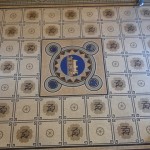
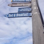
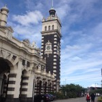
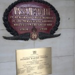
On the fourth day, we started the journey with the first stop at the world’s steepest residential street at Baldwin Street, Dunedin. The street runs up the northern side of Signal Hill, a prominent hill overlooking Otago Harbour at slopes of up to 1:2.86 (for 2.86m horizontal distance, a rise of 1m). The steepness was unintentional as grids were laid out by surveyor without proper regard for the terrain. Our next stop is Dunedin Railway Station which is set in Flemish renaissance style. We were amazed by the conservation of the architectural. The booking hall features a mosaic floor of millions of Minton tiles. From there we proceed to the next stop at Flat Top Hill, central Otago. Due to its geographical location, it is in a “rain shadow” with less than 350mm of rain falls each year. Summers are hot (up to 39 deg C) and very dry. The area includes historical evidence of European and Chinese settlement. At the end of walking track, there is a Butcher’s Dam. The dam is now private owned who have kindly allowed public access across the dam to the Flat Top Hill conservation area. We left and continued on a long winding road by State Highway 8. On the way to Queeenstown, we stopped by Bruce Jackson Lookout whereby there is a signpost pointing out to many different directions like Milford Sound, Christchurch, Invercargill, Mount Cook and etc. About 30min of ride, we stopped at Cromwell lookout. There is a dam named the Roaring Meg which is the turbulent stream that both drives this hydro electric power station and merges with Kawarau River. The weather is just right for a ride down to Gibbston Valley. It is a home of Winery, restaurant as well as the largest wine cave in New Zealand. Opposite the restaurant is a cheesery which sells good cheeses. Then we continued our journey all the way down to Queenstown and checked in Heartland Hotel for the 99th stay.

Adventure Ride from Auckland to Milford Sound in 8 days

17th Sep 2013, Tuesday  (Before starting the Journey)


We went for a ride up to Mount Eden, Auckland after getting Sertao BMW bike from Experience Motorcycle handed over and we were just in time for our first sunset.


Day 1 – 18th Sep 2013, Wed (from Auckland to Tongariro National Park)


It was an exceptional sunny day for a good start of bike riding. After breakfast at Olaf Restaurant, Mount Eden, Auckland we started our adventure riding at 1030am. From Auckland, we took state highway 1 towards Hamilton. We were looking for Highway 22 route on the way. It took us quite some time to find out before giving up. We asked for direction at petrol station and we were lucky to meet friendly bikers to show us the direction. We started the off road riding at Pukekohe.


Highway 22 is indeed a recommended unsung scenic route to explore the true beauty of North Island. There is about 30km of adventurous gravel road in the journey. It was a slow and careful ride due to the bad surface, full of potholes and animals’ crossing. From highway 22, it leads back to main road and heading towards Tongariro National Park. Mount Ruapehu is looming in front of us as we were approaching the destination. The total journey takes about 435km and 9 hours of ride included breaks in between. It gets darker and colder as we reached at destination at 7pm. We were totally exhausted after this ride due to the weather. We checked in Plateu Lodge for a good rest.


Day 2 – 19th Sep 2013, Wed (from Tongariro National Park to New Plymouth)


At 730am, we continued our journey after packing. It was a cloudy day. We took Forgotten World Highway towards New Plymouth. 12km of the highway is unsealed road and there is no petrol station on the way. Therefore we filled up the tank before moving. The total 155km of adventure begins at Taumarunui and ends at Stratford. It follows ancient Maori trade routes and pioneering farm tracks, through ambitious historic settlements, untamed native bush and stunning natural scenery.


On the way, there is a detour along Moki Road leads to a 20 minutes walk to Mt Damper Falls. It is the North Island’s second highest waterfall and is the spectacular sight. Shortly after that, there is a single lane 180m long Moki Tunnel that was built in 1936 and is known locally as the Hobbit’s Hole.

From Forgotten World Highway, it merges to state highway towards New Plymouth.  On the way, we stopped at White Cliff for a short break

Walkway map at the entrance of White Cliff


The whole journey took about 380km and 6 hours to reach at destination. It was a heavy downpour when we reached at 6pm. We were lucky to have checked in Duck and Drakes Lodge by then. Following is the route map of Forgotten World Highway from Taumarunui to Stratford:


Day 3 – 20th Sep 2013, Thu (from New Plymouth to Wellington)


We departed at 9am for another 350km journey down to Wellington. When we left New Plymouth, it was foggy on the road. We have difficult vision and missed out some of the great views on the way such as Mount Taranaki.  However, the sky clears up in the afternoon. We were riding along the coastal route, taking state highway 3 towards Wellington passing Opunake and Wanganui on the way. We stopped at Wainui Beach for a break.


It was an easy ride and took us about 6 hours to reach at destination. It was windy and heavy downpour in Wellington as we reached. We checked in Kingsgate Hotel at 7pm.


Day 4 – 21st Sep 2013, Fri (From Wellington to Kaikoura)


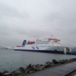
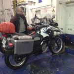
We left the accommodation at 8am to catch ferry Interislander at 830am. It was drizzling in the morning. We checked in the bike at Deck 3 then chilled out at Deck 7.


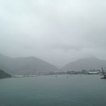
There are lounges around which allow passengers to have rest and to dine while enjoying the views outside the ferry. It passes through Marborough Sound but it was a bad weather therefore vague visibility to behold the magnificent view around the islands. The journey took about 2 hours from Wellington to Picton.

After checking out the bike, we continued our journey and drove past Blenheim through state highway 1. It was a sunny day for a good start in South island. We stopped at Half Moon Bay for pictures.


It took about 5 hours from Picton to Kaikoura. At about 6pm, we reached and checked in Dolphin Lodge.


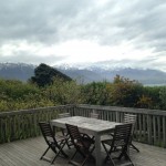
View from Balcony at Dolphin Lodge

Before night falls, we had a stroll along Kaikoura Peninsular and a walk around Kaikoura town center then discovered that there is a vintage car rally.


Day 5 – 22nd Sep 2013, Sat (From Kaikoura to Christchurch)


We departed to Christchurch at 10am and no back road this time. We drove past Cheviot and Waipara along the shoreline. We reached about 6pm just in time before the rain started. We checked in Jailhouse Lodge. This lodge used to be a female prison, which was built because of the overcrowding at Lyttelton.


Day 6 – 23rd Sep 2013, Sun (From Christchurch to Queenstown)


It was a great day to continue to the last town before heading to Milford Sound. We spent about 2 hours on bike service before continuing as it reaches about 1500km by then. From Christchurch, we drove down to Rangitata then taking highway 79 passing Geraldine towards Lake Tekapo.

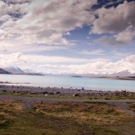
Lake Tekapo is located at 42km west of Fairlie, with an altitude of 710m. The most striking thing about Lake Tekapo is its extraordinary colour in which the light reflected from microscopic rock particles suspended in glacial meltwater lends the water an ethereal opaque-aqua hue. We stopped at the well-known Church of the Good Shepherd, an enchanting little stone church built in 1935 as a memorial to the Mackenzie Country pioneers.


We also photographed the Collie Dog Monument that is about 100m to the east of the church. It was erected in 1968 by local sheep farmers to honour the dogs that make it possible to graze this harsh terrain. We reached at Lake Pukaki after about 20min from Lake Tekapo. It is just located next to each other but it is an unsung destination with no sign of tourist.


From there we continued towards Twizel and Omarama then Lindis Pass. It was getting dark as we arrived in Wanaka and had a break at Lake Wanaka for sunset.

From there we drove towards Queenstown through the back road. It was about 8pm when we reached at A-Line Heartland Hotel.


Day 7 – 24th Sep 2013, Mon (Queenstown)


We stayed another one more night in Queenstown to explore further. We had breakfast at Post Office Café.


After that, the first stop is Glenorchy, at the head of Lake Wakatipu 50km northwest of Queenstown. The scenic drive along Lake Wakatipu takes about 30km to The Wharf Shed. The lakeside drive passes Bob’s Cove, the best place to observe the lake’s seiche, a phenomenon which causes the lake level to fluctuate by around 150mm every five minutes.


The whole journey along the lakeside drive takes about 30minutes to reach The Wharf shed. The shed is originally built by NZ railway department as a goods shed for freight carried on the steamers between Queenstown and Glenorchy. There is a well-trained dog ready to play with tourists around the shed. The dog is smart to understand human, as it would play until you bid farewell. We manage to relax at the abandoned wharf under the sun. Then we proceeded to Moke Lake. The access is along the way but the it is about 20km gravel road.


We were in Arrowtown for sunset. The town still has the feel of an old gold town and retains the spirit of a living community with grocers’ shops, pubs and post office. After the short walk in Arrowtown, we proceeded for a dinner at Skyline by Gondola.

Day 8 – 25th Sep 2013, Tue (From Queenstown to Milford Sound)


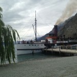
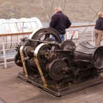
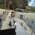
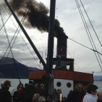
From Queenstown, we took the steamboat, TSS Earnslaw to transport the bike across Lake Wakatipu to historic working station of Walter Peak. TSS Earnslaw is a magnificent vintage steamship believed to be the only coal-fired passenger- carrying vessel still operating in the southern hemisphere.

From there we continued on the Mount Nicholas gravel back-country road along the Western Shores of Lake Wakatipu with few ups and downs all the way through to Mavora Lake with 2 river crossings. There is no other food or drink along the way or petrol station. 20km after the second river crossing, we reached at Mavora Lake where we had a break.

Then we continued our journey towards Te Anau after Mavora Lake on state highway that took us about 30minutes of ride. It was about 6pm when we reached at Te Anau and had a break at Pop In Café next to Te Anau Lake.


The journey towards Milford Sound from Te Anau took us another 1 hour of ride. It is a scenic route along the way through Homer Tunnel passes Mirror Lake, the Chasm, Milford Sound National Park and water falls.


Finally, the adventurous riding ended at 730pm at Southern Discoveries accommodation!


New Adventures will follow, for sure, If the Adventure bug hugged you, you are hooked, it will be difficult to relax