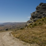
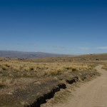
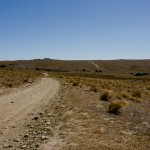
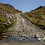
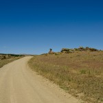
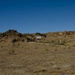
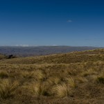
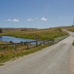
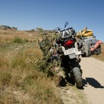
guaranteed wet feet

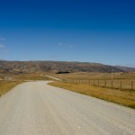
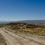
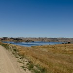
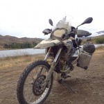
There are not many country roads left on the South Island which I didn’t ride on, on my Adventure bike. It took some time and a lot of research to find the right initarary to combining all back roads I want to do into one round trip which start in Milford Sound and end in Milford Sound.

As I can remember I left after work, weather was not good at all rain in Milford Sound, road restrictions are issued around the Homer Tunnel, road was going to close at 5.00 pm due to heavy snow fall over night, which is not common at this time of the year. Despite the driving restrictions I took off, to make my way to Te Anau my first stop to buy food for next few days, after I did all shopping and refilled my bike, I drove to South-arm of Lake Te Anau. I toke the state highway to Manaporie and from there I followed the Scenic signage to Tuatapere, at Blackrock Station is a turn off to Borland Lodge, there I take a right turn and follow the road, first 9 km are tarmac the remaining km is very good gravel to ride on; around 60 km one way. At the south arm is a DOC camp ground in the middle of the forest, I juice to camp in an open area beside the Lake with a magnificent view to the mountain and surroundings of the lake, I have been very lucky that night to spot a deer, which disappeared very soon into the thick dark forest.

I woke up early in the morning to make my breakfast and get ready for my next destination Invercargill. As soon the air warmed up the sandfly got more and more, I broke all records to pack up my gear on the bike, it has been insane to experience that many Sand-fly that early in the morning.

In Invercargill I booked a BBH Hostel, Southern Comfort it is very tidy and quiet accommodation. Shopping centre are very close too.

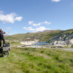
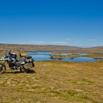
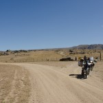
My day 3 of travelling started with loads of fun: I meet two Malaysia girls, Tan and Yunee as soon they found out that I am a chef we did a spontaneous cook off, in the kitchen of the Hostel; it was the best start into the day, after we finished our breakfast we took or own journey to different destination. Some how I felt sad to leave so early; but I need to get to my next destination Purakaunui Bay Road, at the end of the road is a DOC Camp, which I would say is one of the nicest I have been so far. In Fortrose I turned right to avoid the main road in direction Otara, the road is very narrow and unpaved, there are so many look out spots which have not been mentioned in any travel guide which are breath taking, with a magnificent view to the rugged coast line. My next morning started early, I broke off already by sun rise already to drive up to Waikouaiti were I took the Ram Rock road to Middlemarch. As soon I turn onto the Ram Rock Road the gravel started, I meet some farmer beside the field which was a good opportunity for a small talk about the area, kettle and sheep farming is the most income of the farmer in the are. The winter month I could be very harsh due to very cold temperatures and gale force winds which could be very destructive to the native fauna and flora. The road was very easy to ride on, not a big issue. My original plan was exploring Lake Onslow Road, the weather turned, to be very bad, wind picked up to make a save bike ride nearly impossible, to all my surprise it started snowing, it was already early summer, I reached Clarks Junction, where I stopped and had a hot drink to observe the black clouds rolling over the area I wanted to go, once more I need to make a decision if I want continue my original plan or turn around and look for a alternative route. Even the barkeeper suggested to avoid the Lake Onslow Road, ant look for an alternative, If I would continue my original plan I need to take Serpenine Road that road is in a very different condition, not maintaineced for many years with very deep mud pools, rain water which is filling up mud pools could be wheel deep. At the end I decided not going ahead with my original plan, and turned around and drove back to Middlemarch than Hyde, Ranfurly to St Bathans. Where I camped beside Blue Lake. Once more it was freezing at night not as cold as many nights before top low was only -2C, now I realised it must be very close to summer. ^_^. As soon I opened the tent I got blown away clear blue sky!!! But a bit chilly. Only one hour later the temperature reached 15C. It will be a good day for adventure riding. One of my friends Klaus told me a long time ago there is a pass from St Bathans to Oramara, which is not easy to ride on a fully loaded adventure bike, I still remember his words, but took off onto Hawkdun Runs Rd from there I followed Broken Hut Road, I loved the ride in the early morning hours, at one stage there is a Y junction left road is going to Omarama Saddle with more than 30 river crossings exposed 4 wheel tracks and very deep river even by low water. I took the right turn there are 6 river crossings only, one of my most difficult crossings at all, are river 3 and 4, big stones and an uneven surface make the crossing very challenging. On river 4 I need to got off the bike and pushed the bike through the rocky river bead I the water was more than knee peep. From there on the road is plain adventure, nothing, I could tell was missing, all my bike skills are needed on the next part up to the saddle. Potholes, deep wash outs, from flash floods running down the road and big rocks are only a few to mention, I loved the whole day riding, it is not more than 35 km’s from my night camp to Omarama but it took me 5.5 hours.

On my way to the Y junction I meet Peter and Lesley from Leviathan Hotel in Dunedin, which took the same road, with out them and there help I probably would still stuck in one of the Rivers today.

After such a big day in one of the most sophisticated areas we went into Omarama for a refreshment. I went back to Wanaka my last camping location before heading back to Milford Sound next day. ^_^


4 season in 8 days


This year I start my first tour early spring, the weather could be very dramatic, and unpredictable. Special on the South Island of New Zealand. The day’s could be very nice and sunny or it could be the opposite, snow could fall up to sea level.

However my first day was an absolute brilliant day, with sunshine low clouds over the Fiord of Milford Sound, and very mild temperatures. After I have had a good breakfast and a strong coffee I started my journey to Dunedin it is a 4.5-hour drive. Where my BMW should get serviced, I have had some unexpected delays on my way, my engine cut off many times as soon I geared down. I was experiencing this trouble already before and contacted my bike dealer. As soon the engine was dying all I need to do open the tank lid, close it again and the engine was running with out any trouble. As I arrived at the bike shop it was late afternoon and to late for the service. The next service which would be available would be in 1 week. There was nothing to do to put my bike for the service the next day, the Manager told me, despite I explained him the situation that I am on holiday and travel to north, even if he could do just an simple oil change would be fine for me. He refused. That was not all; the gasket is leaking too, the bike is just 1 year old and has not more 21200 km.

Early next morning I drove up to Christchurch, visited a licensed BMW dealer, which booked in my bike on the next available day, that worked out for me, and I could do some back country riding. After I left Hamptons Motorcycle, my bike’s engine cut off 3 more times, I did what I did so many times before opened the tank lid and closed it, and continued my riding, until next time engine died.

Finally I took the west coast highway to Arthurs Pass, it was just a 45 minutes drive to the turn off onto Lyndon Road, my first dust road after a long winter break. It was a good feeling, to feel how the tyres bit into the gravel. At lake Georgine I found a great spot to pitch up my tent, surrounded by native fern and the mild splashing lake. The night was looking to get very chilly, it was full moon that night, so I light up a little bon fire beside the tent, and eat my dinner beside. Next morning it was freezing cold just below 0C, fresh snow fell on top of the mountains, during the night. After break fast I got prepared and started my journey.

My plan was to visit the power plan Kowhai, Lake Heron, Lake Ophua, and Lochaber. The whole day was very sunny, the temperature reached tropical 8C at midday. The dust road to lake Heron was in a very good condition, I could accelerate to move on. At the end of the road beside the lake is a nice plateau to have some quick lunch, the contrast from the fresh green to the magnificent landscape let me dream away for some time, out of the short break I planed before, was at the end a 2 hour stop. There is only one road in and out of the valley, to Geraldine, suddenly I need the first time in my life my helmet, I never need it before but now I need it!!!!! It started hailing, hailstones as big as a finger nail, all I can say the hail was a hammering on my helmet, hail stopped as quick as he started, but still some extra croton was needed on the road. After I passed Geraldine my next stop will be Fairlie, at Fairlie I turned into Kerr Clayton Road it is the first part of Lochaber Road, scenery up the road is stunning. It was already late afternoon as I reached the end of the road, it get time to look for a camp spot, not far away from the road is a signed camp site at Opuha Gorge, that night will be one of my coldest nights ever, I camped out in the wild once more, there is a cold front moving in from the alps, locals informed me that night temperatures could get very chilly. I did some winter camping before, put on my thermal clothes, I have had a very good sleep, didn’t feel the cold despite the temperature plunged down to 7C below 0C. The bike was covered in frost the next morning. Fist thing to do after such a cold night, cook some water to make a strong coffee, and lean back and enjoy the sunrise.

Already a long time ago I changed my stove, I used methylated alcohol for cooking but changed to petrol, at low temperatures methylated alcohol could be difficult to light up.

On this day I traveled in direction Mac Kenzie Pass, Lake Benmore, Hakataramea Pass and Mayers Pass to Oamaru.

It was a very cold day again, around 5C and sunny. The day was a very easy and relaxing, good gravel road no camper vans or bicycles on the road, there was only one big decision to make which road I have to take to Oamaru, there are two options first one Hakataramea Road which is a back country road with few Ford Crossing, or the more challenging Black forest road, you need to ask the farmer for permission at Black Forest Station to pay a little road tax to him. It took some time to make up my mind, the cold front was still moving in the wind picked up already, it was much rain forecasted, as friends told me before, if I want to do Black Forest the weather must be very good other wise it could be a very challenging adventure more like a mission.

I decided to ride Hakataramea Road which was a good Joyce. Only after a few km’s it started to snow temperature on my GPS 1C not even close to the pass, Snow got more intense on the way to the highest point of the road, for some reason snow shower stopped before I reached the pass, I was hoping to get a nice photo at the pass with some fresh falling snow. All the scenery changed many times from brown landscape into fresh green farmland, all shades of grey, green blue.

Mayers Pass is not a very tricky section; at some parts deep cliff and drop off make it more adventurous. I passed Serphentine Valley, Elephant hill back road. From there I took SH82 to Kurow. There is no Backpacker in Kurow to stay. So I need to booked a Top 10 Holiday park in Oamaru for that night, to get a hot shower after a few days camping by chilly temperatures.

I have had a refreshing beer that night too. Next morning I drove back to Christchurch to service my bike at Hamptons. Despite the service took longer than expected, I started my journey to Lake Tekapo, it was already dark when I arrived there, the wind was exceptional strong for the time at night, the weather change must affect the unusual strong wind that night. I pitch up my tent in the difficult condition, full of a challenge’s, it took much longer than usual. First I started with placing the tent on the ground put the pegs into the ground one by one, the tent was moving all the time was lifting up and twisted around, until all pegs where placed. Next step put pools into the tend tighten all secure straps, and safety line’s on all sites. Surprisingly few of the secure lines get ripped out of the ground by the gale force wind, during the night. There was no way to light up a bonfire, the wind was just too strong.


Skippers Canyon

Unbelievable scary, with the beauty of a women; is the Skippers Canyon Road which belongs to the top 10 dangerous roads of the world.

The entrance of the road is in the same location than Cornet Peak Ski fields by Queenstown. The turn off is in a long right corner ¾ up the road to the left.

Skippers Canyon road is a historic scenic road 22km in length,, which winds up beside Shotover River one on New Zealand’s richest bearing gold rivers, which was named by William Rees one of the first settlers from Europe.

In late 1862 Thomas Arthur and Henry Redfern discovered in the area of todays Arthurs Point 4 oz gold in 3 hours, they made no secret of the found and soon start the settlement up the river. At the early stage of the gold finding the miners had to find there own way up the river, which was very difficult due the steep mountains and the current Shotover River, at this time many accidents and casualty’s has been reported, which had difficulty of the transport of goods to the end of the river. In late 1800 the first survey has been made to build a road into the valley to make the Skippers Canyon more accessible for the Miners, first Hotels where build beside the road one of them was the old welcome Hotel, today are only the both chimney remaining the other one is the Otago Hotel far up in the mountain, not much left of this Historic accommodation, it can be reached by a 2 hour hike or Adventure bike but, there are a few tricky sections with deep steps that make the ride a bit challenging, a good work out for biker to check his menthaly strength, on one side is the straight rock up and on the other side a steep cliff to the Shotover River. However the access point is behind the historic cemetery. Further up the valley, first challenges waited for the road workers, the rock is very soft and the steep cliffs made the road very dangerous, at dry condition as soon the carriages rolled over the loose rock, the rock turned into dust, as soon the rain started the dust road was very slippery and unpredictable. Under those condition it was no surprise that motor vehicles where banned until late 1900, and no insurance covered the vehicle on this road. Today it has changed; Skippers Canyon Road is a public road from start to end.

Today, Skippers Canyon is a main tourist attraction. On weekends the road is very busy with 4×4 wd cars, at some locations it could be very difficult to pass an on coming vehicle, usually by dry condition is a massive dust clouds visible from the on coming vehicle and a passing spot can be looked at, to let the on coming vehicle pass. For UN experienced driver the biggest challenge is the deep drop beside the road, with no hard shoulder on the side. In 1898 the Skippers suspension bridge where build in just 2 years. Even though the completion of the existing bridge was done after the gold rush was over, it is one of the main attractions of the journey to Skippers Village. The bridge spans from sheer rock faces on both sides and is about more than 100m above the Shotover River.

At Skippers Town village is a DOC campground with basic facilities. The old school house is nicely refurbished and one of the original houses is open for visitors to take a look into the basic live in the gold mining times.


Langkawi

Langkawi is a kind of Tropical Island, which forms out of 99 individual islands. There are two transport options to get to Langkawi by airplane or by ferry. Kuah is the most southern part of the island and the arrival port for the ferry from the mainland of Malaysia.

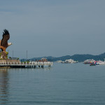
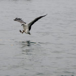
Most of the islands are remote and few of them can be visited by boat. Island hopping is the best way to explore in very short time for different islands. We inquired at the hotel for a special deal to explore the surrounding island, few minutes later we were picked up by one of the tour guides and went to the harbour. As we boarded the little boat we get a small induction and advised to wear life jackets, because the open water could be rough. Our first drop off was at Beras Basah Island (which means wet rice island) with white sandy beaches and a private hut. Wild monkeys were everywhere around the coconut trees and welcoming the visitors. As we looked back to Langkawi Island we could see a massive black cloud is moving towards us and not long later we had a massive downpour but very warm rain. However we had to board the boat for next destination, Dayang Bunting Island (Which means pregnant maiden island). This time we had to enter the open sea and it was very rough on the boat but I had my fun on this ride while others passengers didn’t look that amazed. From the boat we could see eagles far away unaware that we had to pass this area, our skipper stopped very close to the eagle to take a close look at them before we continued to Dayang Bunting Island. Due to the heavy rain, we had to leave the eagles for next destination.

On Dayang Bunting Island, we had to disembark in heavy raining but luckily we found a shed to protect us from the rain. The wind picked up and the waves on the way back are around 1m high, it was a great experience once more to fly from wave to wave and white caps were everywhere the eye could look. As we reached the harbor safely, we went for Chocolate shopping especially when shopping in Langkawi is tax-free everywhere. My friend and I went to a Chinese food outlet and ordered some fresh fish and vegetables as our dinner. On the next morning we were very happy to find out that the ferry to Koh Lipe is still available in month of May although it is stopped as stated in website due to raining season. We then made last minute decision and traveled about 2 hours from Kuah town to Telaga Harbor in order to catch the ferry to Koh Lipe. For your information, it is also known as the little Maldives in South East Asia but It belongs to Thailand therefore we will need to go through immigration counter and get passport chopped to cross. We were very excited to make it for the legendary island!

Overall in Langkawi, there are options whether to stay in luxurious Hotels or a budget hostel as you may easily find one. Many would opt to plan in advance so as to save cost from last minute booking. However, we found out that if you look for special deals on the Internet few days before you arrive and you are still in time to get first class resorts with special prices especially during low season. Let’s explore Langkawi!

Koh Lipe

Maldives of Thailand


Koh Lipe is one of the smallest islands, which belong to Thailand; this small gem is located in Andaman Sea. In the summer month is a ferry shuttle going from Langkawi twice a day to Koh Lipe, the ferry ride is going through the open sea and take around 1.5h for the 35 km journey. Many little island passing by on the left and right side of the boat.

The first highlight is at arriving at the harbor at Koh Lipe, there is no jetty or any thing look like, small boats which called taxi too will stop beside the ferry and the passenger have disembark on the open see and climb into the local boats to get on land.

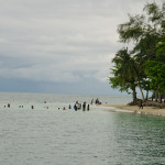
For the last few meters each individual has to walk a short distance through the warm crystal clear water to the beach to get to the Immigration where the passport get hand handed back to each visitor, the whole procedure was a new experience to me, the immigration officer was calling the nationality and name of the passport holder.


Just beside the immigration office is Harmony café and bakery located, I would say the best long black coffee on the island, a small selection of international bakery is offered too such as Danish, Muffins and Scones.


The taxi service is based on motorbikes with sidecars, easy to get on and get a lift to the booked accommodation. On our first night we stayed at sunset beach at Porn Resort in a small bungalow, which was very warm, and no air conditioning was set up just a fan on the wall. For my first time I saw a tarantula spider in the room as I went for a toilet at nighttime, it scared the s… out of me because I didn’t expect anything like that to see at the wall in the bathroom. Spider was around 5 cm in diameter.


Our second night we spend at Wapi Resort which is located at sunrise beach, south of the Thai Andaman Sea, this resort is absolute spotless clean any where you look. Free Wi-Fi gets provided on the whole property. At the beach is the massage center located I took a traditional Thai massage which was very relaxing to listen to the soft rolling of the waves at the beach.


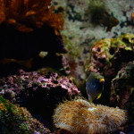
On the next day we booked a snorkeling trip by Baan Kasirin, which included 5 individual stops on different location, we had nothing to took at food was provided, drinks, fins and snorkeling mask even swim vests every thing was provided. All locations where special with so many different corals on the ground the visibility was awesome crystal clear water, the corals where very color full and the fishes where in all bright colors you can imagine, yellow, orange, green, purple. I never experienced that much variation of fishes in the water.


On our final and last night we want stay some where close in town and we booked Lipe Inn Motel, the price is reasoble but no breakfast get served. Every thing is in the room what is needed free water bottles, shower and a air conditioning.

For breakfast we went for one of the street stands, and ordered Thai panama and chocolate pancake, mango and sticky rice, and to drink a fresh coconut, the perfect start into the day.

It take us just few minutes to walk into the main street, to get our last dinner in one of the famous fish restaurants, don’t get surprised if the restaurant is not open at 6.00pm, it is far to early. All the staff set up the BBQ and fresh fish display in front of the restaurant. All kind of fish is available squid, jumbo prawns, tuna, crab is only a few I can remember, charged get peer kg. One of my best seafood I ever had.


The ferry to Koh Lipe from Langkawi operates only in the summer month. It depart from Telaga Harbour to Koh lipe twice a day. The seats on the ferry are very limited if you want guarantee a seat I would recommend to make a online booking few days before you travel.


Old Dunstan Road

This is one of my favorite Central Southland routes, on a clear sunny day the road is absolutely heaven for adventure riding. It can be done on a rainy day too but the road will change into a single mud track. I have done the road on both conditions and had at the end a big smile on my face despite the rain and mud challenged me to keep the bike up. The difficulty by wet condition is that the rain fill up the road and it is possible that the water level is front wheel depth. Underneath the water is the original track which is heavily used by 4X4 cars, and the cars left big drive lines behind which are not visible from the bike so the risk is very high to slope and slide to the side in the middle of one of the mud pools and drawn down the bike. But by dry condition the track is fine to ride, there are few passages which need extra care since flat gravel is very loose on the driveway the bike could slip on those medium size flat rocks, especially if you travel down hill.


My journey started in Alexandra and I drove up to Galloway, from there I turned onto Crawford Hills Road, where the Gravel road begins. It is a very well prepared road with some nice lookouts on the Dunstan Mountains and North Gough Ridge. The Old Dunstan Road is just a short drive from this point and it is sign posted on Old Dunstan Road or Poolburn Reservoir. The scenery changes from now on many times beside the road pile up rocks and pillars which are very impressive.


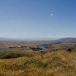
My favorite camp spot is above the Poolburn Reservoir, with a great 180 panorama view, by day and night. Just few kilometers up the road is the first gate, from this part of the road start private land, please stay on the track because the environment is very fragile. After the second gate is a junction if you go to the right you get access to Long Valley Ridge Road which is connected to Serpentines. I decided to stay on the road and drive to Linnburn runs. There is many livestock on such as sheep and cattle, the road is very exposed and steep.


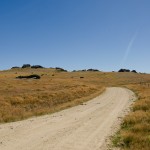
The Linnburn Runs is the first part of the Old Dunstan Road, follow the sign post Paerau which is a historic settlement, remaining of the Styx Jail and the Historic Hotel dated back to 1861 are a good opportunity for a short stop before continue the second part of the Old Dunstan Road. The road is like a highway on gravel, but not a single pot hole or bump. First highlight is just after the first crossing of the upper Taieri bridge, an old grave yard which is dated back to the time gold has been discovered in this time around 1861.  The highest point of the whole road is around the next corner of 918m.


There is one more lake to come Longburn Reservoir, even though it is close to the highest passing point of the whole road it is a good place for camping out before continue to the next day’s journey to Dunedin. The whole road is about 190km off road with different kind of landscapes and changing sceneries, however there is no washroom along the road for a comfort stop.


Actually, Old Dunstan Road will be closed in the winter month from 1st June till 1st October. I highly recommend this trip and do some amazing back country camping, to do the whole road over 3 days is really worth it!

Borland Road

Borland Road is the only road access to the South arm of Lake Manapouri.

Construction of Borland road begun in 1962, to enable to service the Power line from the Power Station on Lake Manapouri. Today the road is important to outdoor enthusiasts. Many tramps start beside the road or on top of the Borland

Saddle, even a camp spot is set up with toilet facility’s.

The access point is in between Clifden and Manapouri just north of the Blackmount school, a bus shelter is beside the access road.

The road condition can vary from the weather condition, in winter month it is possible that the road is closed by snow fall. A round trip from Te Anau to the South arm is around 180 km 90 kms are unsealed road but very easy to drive no river or ford crossings for the whole distance.

An ideal pick nick spot is the south arm very idyllic and romantic to watch the sun set at lake Manapouri, a camp spot and some toilets can be found at the end of the road.

Please remember take all your rubbish back out and leave the place as you found it untouched and leave only your foot prints in the sand as remaining you have been visiting this place.

There is one accommodation at the Borland Road, the Borland Lodge. In the summer month the huts can be fully booked by school classes and groups.


Macetown

Macetown is a historical gold mining settlement in the Arrow Gorge, situated far up in the Mountain.  The access can be found in Arrowtown by the car park which is close to the Chinese village.


This settlement can be reached by foot, bicycle, and Motocross bike or 4wd vehicle. The road crosses 22 times the Arrow River and creeks on a distance of 15km. Over the past few years the road has not been maintained on some sections so the road is very rough with deep drive ways. The most river crossings are by the first 3 km’s drive ways of the 4WD vehicle. The water could be 1/2m deep and the underground is very loose so be careful if you cross the river with your bike and check the tire pressure first before driving through the water. I drove beside the drive way and the water was much shallow and the only difficulty was the hidden big rocks along the waterline. I drove slowly and then increased the speed by driving out of the water. It is safer to stand than to drive seated. This is due to the fact that in a standing position, the bike can be much better controlled and balanced if you slip. This is just in case you come off the bike by the river crossing. It is much easier to balance the bike if the engine happened to turn off.


On the way back to Arrowtown the sun stood behind us and the river was like a mirror. There was nothing to see what was hidden under the waterline. The only way to find out was to get off the bike and walk through the river to find a good line to pass. At some parts close to the end of the river side, the water was around 21 inch deep although we have had no rain for around 3 weeks. Before going up the mountain, I advise to check the river current if the rain drop in the river rises rapidly then a crossing could be impossible than before.


History of Macetown is dating back to 1862 when William Fox discovered gold for the first time in the Arrow River. In a very short of time the population of the little township grow up to 1500 miners at the junction of 12 mile creek. By 1865 most of the gold was excavated by the miners and the population shrunk rapidity.


At the early 1900 the town was deserted, only a few original building are restored and one of them is the Baker house. This is the first building visible of the historic Macetown. Department of Conversation has successfully restored those buildings over the past few years.


Macetown had a small Chinese community, which was based by the end of the main street in the area known as Chinatown. The Chinese miners kept up the Chinese tradition and celebrated all annual events such as Chinese New Year and moon light festival.


My verdict of this trip is highly recommended for Motorbikes up to 650 ccm, with a huge fun factor, I have not been such exhausted before for a long time after this trip. At the end, after 44 river crossings I just dropped my bike to the side then switched off my engine although the back wheel still in the water. I lifted my arms and shouted I made it safe and dry! it was such a great day! Once more I had experienced in the most amazing part of the world in the rural untouched back yard of Southland 🙂


A road with more than 15 gate to open or close

The Thomson Road in the Dunstan Mountain is a historic road which is open year around in the summer time is a 2 WD road while a 4WD in the winter month. It is a remote high country road where some examples of early gold mining and early settlement in the Dunstan Mountains are discovered.


This historic road follows beside Thomson Gorge Creek with a few ford crossings. By dry conditions, the fords are half wheel deep, but very rough to ride through on a motorbike. The easiest access is the turn off by Lindis Crossing. The turn off is just before the left turn onto a bridge to the right, driving direction from Alexandra to Tarras.


In late 1862 the first miners were crossing over from Manuherikia Valley to upper Clutha Valley and discovered gold in the river. The Thomson Gorge track was used by miners and traveler who made their way to east or west.

There are many historic sites beside the track, most of them are on private land. Visitors should respect the privacy of the land owner and should ask for permission to enter the land before trespassing.  If access is denied there is a good reason why the land owner denies the access.


The road is very easy to drive in dry conditions and by rain there are not many rough sections along. The only big challenge is to open or close the gate on the road in total there are 23 gates to open or close! Jumping off and on the bike keeps you busy and it takes longer than riding the whole road from east to west. The roads winds up into the mountain over the Thomson Saddle (900M) into the Bendigo area on the eastern side of the range. Not far away is a stone hut build beside the road in 1908, which provides shelter to the traveler on the way to the goldfields.


On top of the Saddle is a magnificent panorama view into the Southern Alps and lake Hawea, Lake Wanaka, and upper Clutha. I have not found a good camping spot beside the track yet. The underground is very rocky, or live stock is around, mainly sheep. The valley is very wide and it changes the scenery more times. Many picnic areas are located along the track so remember to take your litter home with you.


Wilderness is an unforgettable experience


Exploring Mt Aspiring National Park is an unforgettable experience with striking landscape formations and bush lines. Mt. Aspiring is located to the South West of Mt. Aspiring National Park. It has a World Heritage status. The wilderness of Mt Aspiring has attracted many outdoor lovers over the years. Outdoor activities like hiking, bouldering, climbing, fishing and cycling are the main targets for many to visit the untouched place. In Wanaka, Mt. Aspiring National Park is well signposted and it is easy to find the way.


On the way out of Wanaka, the Top 10 Holiday Park is just located next to the road and is a very nice place with a great view to Lake Wanaka and the surrounding Mountain.  At Glendhu Bay, there is a typical Kiwi Style Camping Ground which is very busy through the summer month. By Kiwi Campers the privilege of this camp site is to have direct access to the lake and has a boat ramp to lunch the boat into Lake Wanaka. Just a few kilometers away from Glendhu bay is a turn off to west Wanaka Rd, if you take this road it will lead you to West Wanaka Station. There is a DOC car park the perfect start to explore the west side of Lake Wanaka, this location is a good place for fishing in the pristine waters.


To travel from Wanaka to Raspberry Creek is a good day encounter with enough time for a rewarding picnic beside the slow flowing river Matukituki. As we are back to the Wanaka, we take a right turn at Mt Aspiring road towards the mountains. From this part of the road is the road into Treble Cone which is already visible to the left. The first attraction is Diamond Lake, a small lake imbedded into a harmonic landscape, and toitoi.


On the last meter on tarmac is the turn off to Treble Cone. The road is in a good shape to drive up to the Cornet Peak ski lift, on top is a starting point for hang glider on warm days is a very rewarding thermal wind which gives the hang glider a good lift into higher levels. Standing at the car park of Ski lift is an awesome panoramic view to Dunstan Mountains, Lake Wanaka and East of Otago.


Back to the Wanaka, we take a left turn at Mt. Aspiring Road and a yellow signpost signals the start of the Gravel Road for next 40km, the gravel is very loose some times and many pumps are on the drive way which can make the driving exhausting by too less speed. However, the braided river valleys, native bush land, alpine meadows with relaxing sheep’s and cows rewarding the drive into the dramatic Southern Alps.


Short after Mt Aspiring Station is the first Ford Crossing usually it look more dramatic than it is very settled underground and easy to drive through, from that point the scenery get better and better, the road follow the braided river valley, with many romantic places to camp or just having a rewarding picnic beside the relaxing flowing river. At the end of Wanaka Mt Aspiring Road is the Raspberry Creek’s car park, with toilet facility. From there, it starts up the day with a walk into the national park. It takes around 3hours for a return trip. For more adventurous individual, you may start the multi day hike back to Glenorchy. Remember not to litter the countryside and to take all the rubbish back with you out, and leave only your foot prints behind. This is for the effort of protecting the beauty of our nature for our Children.


For more information about activities please refer to DOC office in Wanaka and to find out more about the latest updates about the area.


Department of Conservation


Lake Wanaka Area

Office
PO Box 93

Lake Wanaka

New Zealand.

Ph +64 3 443 7660      Fax + 64 3 443 8777

mailto:mtaspiringvc@doc.govt.nz

Portfolio of the Photographer Frank Widmer