Haikou


Haikou


Haikou is the capital of Hainan province, P.R.C. It is situated on the north coast of Hainan. The northern part of the city is the district Haidian Island, which is separated from the main part of Haikou by the Haidean River, a branch of the Nandu.


Haikou was originally a port city. It still plays a important part in the trading and many goods goes through the he ports.

But today Hainan is one of the tourist meccas of China with white sandy beaches and crystal clear water. Many international Hotels are located on the beach site.


Arriving at Haikou 

Hainan is not to far from Hong Kong, it takes only a 1.5 h flight to Haikou. I applied directly in Hong Kong by the Chines authority for my Tourist visa which got issued after 3 days, the process was very convenient and easy, pass photos could be made on the premisses and copies which are needed too, you need some extra cash for the extras.

As soon i arrived at Hainan International Airport I felt the difference of the heat, it is much warmer and little more humid, I felt it very comfortable. From the Airport I took a taxi to my accommodation, Sheraton Hotel  we drove for around 45 mins and the taxi driver charged me 160 RMB. The Hotel is directly beside  the beach, even so the out door facilities are in a top condition.

Climate

 Haikou is on the northern edge of the torrid zone, and is part of the international Inter-tropical zone. April to October is the active zone for tropical storms and typhoons, most of them occur from August to September. May to October is the rainy season with the most rainfall.

Despite his location, the city has a subtropical climate with some strong monsoonal influences. However the area has hot summers and warm winters, usually with high humidity.. Extreme temperatures can range from 2.8 to 39.6 C. From June thru October torrential rain may occur, with 7 days annual rain fall.

Nightlife

Haikou has a very active nightlife that continues each evening until dawn. Bars are patronized until after midnight. Road side BBQ sites are very common through the city and offer some snack food even full meals, I dried few of the stands the food was very tasty a very good option if there is not much time to go for a restaurant for lunch or dinner.  Sometimes they comprise tables, plastic chairs and a restaurant set up. This business operate from around9.00 am to 3.00 am.

By Air

 Haikou is served by Haikou International Airport, which is located 25 km, 16 mi from the city. In front of the terminal are waiting licensed taxi which will bring you to your accommodation in Haikou.

Shuttle buses are waiting beside the International terminal which will bring you to the city, to the main bus terminal. If your accommodation is located close to the city it is more convenient and much cheaper to take a Taxi from the main bus terminal than from the Airport.

External link

Haikou Government (Chinese)

Haikou Government (English)

Haikou free trade zone

Sheraton Resort Hotel


For more information I refer to Wikipedia

Continue reading “Haikou” »

Sai Kung

Sai Kung


Sai Kun is the second largest district in the Hong Kong area. It compromises the southern half of Sai Kun Peninsula and Clear Water Bay Peninsula in the new territories plus a strip to the east of Kowloon. The district has the second youngest population and residents. It consists around 70 islands of different sizes.

Sai Kun town is a former fishing village, and is a heaven for Seafood lover, in front of the promenade are the best restaurants Sai Kun has to offer with fresh fish specialty’s and big aquariums with all kind of fish, mussels, and alike.

Sai Kun has some of the most beautiful and cleanest beaches in Hong Kong, (Clear Water Beach1 &2, Silver-strand Beach, Tai long Wan or Big Wave Beach)

Sai Kun District is served by Sai Kun Magazine a free distributed English newspaper.


Geography

In contrast of Hong Kong and Kowloon Sai Kun has a remote and idyllic costal area, with charming small Villages beside remote beaches and stunning seascapes. The locals describe Sai Kun as the last untouched back garden of Hong Kong.


Transport

The MTR system has currently 4 stations in Tseung Kwan O New Town. The new Town is also served by comprehensive bus network that connects it to Kowloon via several main roads including Tseung Kwan O Tunnel and Po Lam Road.

The nearest MTR station to Sai Kun is Hang Hau.


The most beautiful places in Sai Kun can only reached on foot or by boat. Where a destination is accessible by public transport, it is usually served via a complicated network of bus routs.

Some useful information about bus routes could be found here 


Local and tourist attractions

There are numerous cultural sites, and country parks in the Sai Kun Peninsula:


Sheung Yiu Folk Museum

Sai Kun Outdoor Recreational Centre

Sai Kun East and West Country parks

Jin Island or Tiu Chung Chau

Leung Shuen Wan Tin Hau Temple

Jockey Club Kau Sai Chau Public Golf Course


External Link


Sai Kun Magazine

District Council website 

Explore Sai Kung 

MTR


Cheung Chau

Cheung Chau


Cheung Chau is a small island 10 km south of Hong Kong. It has been inhabited for longer than most places in the territory of Hong Kong. There are living around 23.000 people on the Island in 2006. Administratively, it is part of the Island district.


Economy


Under the terms of the 1898 Second of Convention of Peking, the New Territories and 200 smaller islands including Cheung Chau were leased to the United Kingdom for 99 years at that time. Cheung Chau was mainly a fishing village. People from other places in South of China have settled the Island; for example Hoklo, they are mainly fishing people, Hakka people; Chiu Chau; and Yue Ca. The Island slowly evolved into commercial hub with merchants selling supplies to the local fishing people, boat repairs and fishing gear as well as part to do business and small farmers nearby on Lantau Island.


Transportation


First Ferry operates in between Central and Cheung Chau from the Ferry pier in Central. The Ferry run approximately every 30 minutes, depending time of the year. The trip of about 20 km takes around 55 minutes but it depend on weather and sea condition.


Bun Festival


The annual Cheung Chau Bun Festival is a festive celebration, which include a parade which start at 10.00 am on that day. It get extreme busy on that day I recommend an early start into the day otherwise the queue at the pier is as long as the Warf it self. Most famously including young children dressed as famous characters doing impossible balancing acts.

The highlight of this festival is climbing up the bun tower at midnight, the higher the competitor climb and the more buns he collects from the different level the more points he gains. The buns are marked on the back and get counted as soon the competitors get safely back on the ground after be bell sounded.


External Link


Cheung Chau Bun Festival

Gertrude Saddle

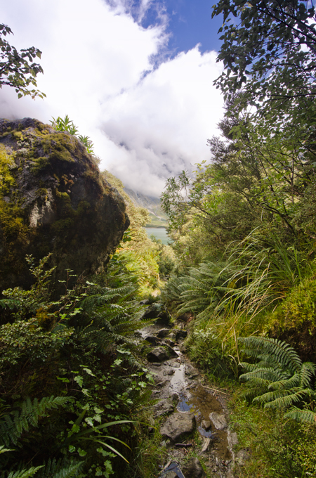
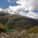
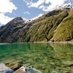
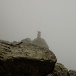
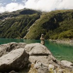
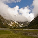
Gertrude Saddle hike is the only day hike in Fiordland, which offers at the ridge free few to Milford Sound and the Tasman Sea. The track start to the right of the Homer Hut, a green post indicates the entrance into the Valley. There is a beaten track to the end of the valley, close to the end of the valley are stone markers visible, usually they are placed on top of boulders and always visible. The last 1.5 km’s are taking much more time than expected, it get very steep and the track leeds over exposed sections, the last 200m before you get to Black Lake you have to walk over a blank rock which could be a bit slippery after rain, extra caution required at this part. At Black Lake keep to the right once more walk up the granite slope this time there is a steal rope attached to hold on. From here the saddle is already visible and not to far away, keep orientation on the stone marker to get up to the Saddle. On top of the Saddle are 2 spots to pitch up the tent if you like to spend over night, I really enjoy camping up there awesome night sky and beautiful sun sets could be seen from here.

Cleddau Valley

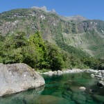
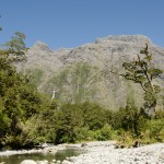
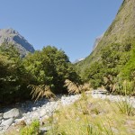
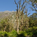
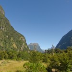
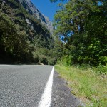
The day started with sunshine what is not common in Milford Sound at this time of the year. I decided to go for a day walk into the Cleddau Valley, just around the next corner. A good starting point is the Blue Duck Cafe and Bar in Milford City, where food and refreshments are available for a day walk.

There is only one road which is going to the Cashem State Highway 94 back to Te Anau. There are many interesting stops on the way, I suggest to stop at Deep Water Baisin to take a close look to our rock lobster fishing fleet, Little Tahiti is not far away just opposite the quarry on the main road, few km’s up the road is the historical swing bridge.  The next stop will be the Cashem.

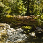
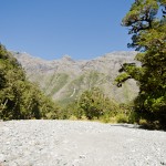
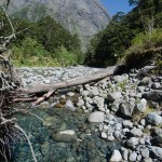
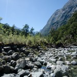
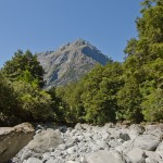
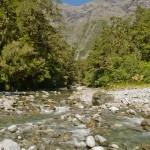
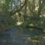
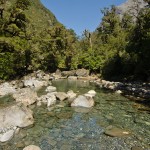
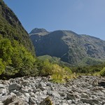
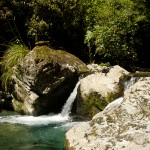
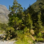
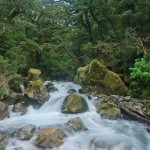
There start the walk into the Cleddau Valley, follow the round course as soon you reach the 2nd bridge, climb the fence and walk up stream, keep on the right sight of the river it is much easier to walk up stream, there is no marked route to the end of the valley.

I recommend to do this hike only if there was no rain for a few days and the water level in the river is very low. After heavy rain the river get a current stream it is impossible and unsafe to make any crossings.

The hike is not to underestimate and take from the Blue Duck return easily 9 h for 29km’s

Inquire first about the weather condition before heading out.

Hong Kong, Macau, part 2

After a long time of preparation for my holiday’s I will visit Hong Kong and Macau for my 2nd time. This time I will stay for 3 weeks in Hong Kong and 1 week in Macau to get in touch with people and see more of the culture and history of this beautiful place. There are a few day walks to explore around HK such as Devils Peak or old HK with some historic houses dating back to colonial times. Or see a concert of one of the great and famous artists in HK would be awesome. In Macau is one famous beach at Taipa Island I want to see, even though the night sky line of the amusements in Macau. There is so much to discover and see, may 4 weeks are not enough time again. I look forward for this amazing trip, and see all my friends too.

Harrison Cove

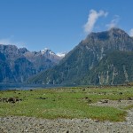
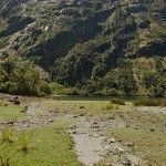
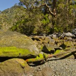
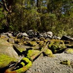
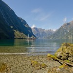
This trip was one of my day trips in Milford Sound to discover Harrison Cove where I spend the whole day on the beach to observe the wild live and find the remains of the former sealing station. Harrison Cove used to be one of the most busiest sealing station in New Zealand Harrison. Fure seal fat has been modified and was used to lighten streets in UK Cove, and the fure was used in the fashion industry, fure seal have one of the densest fure in the world and keep extreme warm. Harrison Cove  is named after Captain John Harrison which invented the first ship chronometer, he build his first longcase clock 1713 with the age of 20.

I refer to an article I found, John Harrison and the longitude problem – national museum to read the whole story about one of our greatest sailor and inventor in sailing.

Lake Marian

Lake Marian is a lake in the Darran Mountains in the hart of Fiordland National Park in the South of New Zealand.

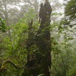
If you have no transport option from Te Anau www.tracknet.co.nz is the best choice to get to the car park at the entrance to Hollyford Valley. From there it take a 1.5h walk to the lake, after around 20 minutes walk you get the first glimpse of the Marian Creek which is a good oportunity for a short photo stop.  From there on the track is well marked and sometimes you have to pass gravel pits. The tramping track is not very challenging, in dry conditions, after heavy rain it get very dirty on some section of the track just before you get out of the forest.

If you like camping in the nature this is the best lace to be.


Tokyo

Tokyo


Tokyo, officially Tokyo Metropolis is one of the 47 prefectures of Japan. Tokyo is the capital of Japan, and the largest metropolitan area in the world. Tokyo metropolitan government administers 23 Special Words for Tokyo (each governed as an individual city). Tokyo metropolis was formed 1943 from the merger of the former Tokyo Prefecture and the city Tokyo. Tokyo has been described as one of the three command centers for the world economy, along with New York and London. In 2012 Tokyo was named as the worlds most expensive city, according the Mercer and the Economist Intelligence Unit cost of living survey.


Geography

The mainland portion of Tokyo lies northwest of Tokyo Bay and measures about 90 km east to west and 25 km north to south. The average evaluation is around 40 m. Also within the administrative boundaries of Tokyo are two island chains in the Pacific Ocean directly south. The Izu Island and the Ogasawara Islands, which stretches more than 1000 km away from the main Island.


Climate

The former city of Tokyo and the majority of mainland Tokyo lie in the humid subtropical climate zone, with hot humid summers and generally mild winters with cold spells. The warmest month is August with an average of 27.9 °C, and the coolest month is January averaging 6.0°C. The record low temperature is -9.2°C, and the record high is 39.5°C. Annual rainfall average nearly 1.530 mm, with a wetter summer and a drier winter. Tokyo have seen massive typhoons each year.


Shinjuku Gyoen Garden

Shinjuku Gyoen National Park is a large public park with an eminent garden in Shinjuku and Shibuya. It was original the residence of the Naito family in the Edo period. Afterwards it became a garden under the management of the Imperial household Agency of Japan. Now it is a public park for all kind of leisure and retreat of the busy city life.


History

The imperial garden, which were once meant for the royalty, were completed in 1906 and destroyed in 1945, during the late stage of WW2. The jurisdiction over the Imperial Palace Outer Garden and Kyoto imperial garden was transferred to the Ministry of Health and Welfare with Shinjuku Imperial Garden in 1947. The garden have a area of more than 58 hectare with a circumference of 3.5 km, blend three distinct styles; French Formal. English Landscape, and Japanese tradition. The garden has more than 20.000trees,including approximately 1.500 cherry trees which bloom from late March to early April, and late on late April.


Entrance and admission

The garden has three access gates, Shinjuku Gate, Okido Gate, and Sendagaya Gate. Shinjuku Gyoen is open from 9.00 until 16.30. On Mondays the gardens are closed, expect the cherry blossom and the chrysanthemum season, late March until late April and early November respectively, when the gardens are open seven days a week. The greenhouse usually is open from 11:00 until 15:00. The admission is

JPY 200 for adults, JPY 50 for children.


Location

The garden is a shirt walk from the Shinjuku Gyoemmae Station on the Marunouchi Line or Sendagaya Station on the Chuo Sobu Line.

The garden is on the Fukutoshin Line near Shinjuku Sanchome Station. From the station the garden is a 4 minute walk.

Shinjuku Gyoen should not get mixed up with Shinjuku Central Park, a small garden behind the Tokyo Metropolitan Government Building in Nishi Shinjuku.


Tokyo Tower

Tokyo tower is a communication and observation tower located in Shiba Park, Minato. At 315 meters is the second tallest building in Japan. The structure of the Eiffel Tower inspired lattice tower that is painted red and white and international orange.

Build in 1958; the tower’s main sources of revenue are tourism and antenna leasing. Over 150 million people have visited the tower since his first opening. The 2 story main Observatory is located at 150 meters, while the smaller Special Observatory reaches a high of 250 meters.


Sky tree

Japan planed a digital television transition by 2011, However Tokyo Tower’s current height is not high enough to adequately support complete terrestrial digital broadcasting to the area. A taller broadcasting tower, known as the Skytree, was completed on February 29, 2012


Tsukiji fish market

The Tokyo Metropolitan Central Wholesale Market, commonly known as the Tsukiji Market, is the biggest fish and seafood market in the world and also one of the largest market of any kind. The market is located in Tsukiji in central of Tokyo. The Market is located near the Tsukijishijo Station on the Toei Lineand Tsukiji Station on the Tokyo Metro Hibiya Line. There are two district sections of the market as a whole. The inner market is the licensed wholesale market, where the auctions and most of the progress of the fish take place. The outer market is a mixture of wholesale and retail shops that sell Japanese kitchen tools, restaurant supplies, groceries, and seafood. Many restaurants especially sushi restaurants are located around the fish market. The market opens most mornings (expect Sundays, holidays and some Wednesdays) at 3.00 am with the arrival of the products by ships, trucks and plane from all over the world. The auction house then estimate the value and prepare the incoming products for the auction. The buyer also inspects the fish to estimate which fish they would like to bid and at which price. The auction start around 5.20 am and finish around 7.00 am


External link

Shinjuku Gyoen 

Tokyo Tower

Tokyo Tower Structure base


Tsukiji Fish Market http://www.shijou.metro.tokyo.jp/english/index.html

Tsukiji Market association http://www.tsukiji-market.or.jp/tukiji_e.htm


Tokyo Metro http://www.metro.tokyo.jp/ENGLISH/


For more information I refer to:


Wikipedia www.wikipedia.org


Portfolio of the Photographer Frank Widmer